Noord-Beveland
| Noord-Beveland (North Beveland) | |||
|---|---|---|---|
| Municipality | |||
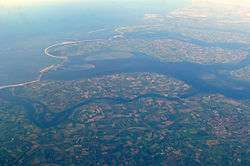 Aerial view of Noord-Beveland | |||
| |||
.svg.png) Location in Zeeland | |||
| Coordinates: 51°35′N 3°45′E / 51.583°N 3.750°ECoordinates: 51°35′N 3°45′E / 51.583°N 3.750°E | |||
| Country | Netherlands | ||
| Province | Zeeland | ||
| Government[1] | |||
| • Body | Municipal council | ||
| • Mayor | Marcel Delhez (VVD) | ||
| Area[2] | |||
| • Total | 121.51 km2 (46.92 sq mi) | ||
| • Land | 85.82 km2 (33.14 sq mi) | ||
| • Water | 35.69 km2 (13.78 sq mi) | ||
| Elevation[3] | 1 m (3 ft) | ||
| Population (August 2017)[4] | |||
| • Total | 7,327 | ||
| • Density | 85/km2 (220/sq mi) | ||
| Demonym(s) | Noord-Bevelander | ||
| Time zone | UTC+1 (CET) | ||
| • Summer (DST) | UTC+2 (CEST) | ||
| Postcode | 4484–4499 | ||
| Area code | 0113 | ||
| Website |
www | ||

Noord-Beveland(Dutch pronunciation: [ˈnoːrd ˈbeːvəlɑnt] (![]()
Population centers
(there is no village called Noord-Beveland itself).
Topography

Dutch Topographic map of the municipality of Noord-Beveland, June 2015
Ganuenta
In Roman times, the town of Ganuenta lay north of where the village of Colijnsplaat is now, a location now covered by the water of the Oosterschelde. It was an important centre for trade. Nearby, there was a temple dedicated to the ancient regional sea goddess Nehalennia. A replica of this temple was officially opened in Colijnsplaat in August 2005.[5]
References
- ↑ "Collegeleden" [Members of the board] (in Dutch). Gemeente Noord-Beveland. Archived from the original on 15 September 2012. Retrieved 12 December 2013.
- ↑ "Kerncijfers wijken en buurten" [Key figures for neighbourhoods]. CBS Statline (in Dutch). CBS. 2 July 2013. Retrieved 12 March 2014.
- ↑ "Postcodetool for 4491EV". Actueel Hoogtebestand Nederland (in Dutch). Het Waterschapshuis. Retrieved 12 December 2013.
- ↑ "Bevolkingsontwikkeling; regio per maand" [Population growth; regions per month]. CBS Statline (in Dutch). CBS. 27 October 2017. Retrieved 27 October 2017.
- ↑ Van der Velde, Koert (August 13, 2005). Zeeuwse godin weer thuis. Trouw (Dutch newspaper), p. 8–9.
External links
| Wikivoyage has a travel guide for Noord-Beveland. |

- Official website (in Dutch)
Places adjacent to Noord-Beveland | ||||||||||
|---|---|---|---|---|---|---|---|---|---|---|
| ||||||||||
Municipalities of Zeeland | ||
|---|---|---|
 | ||
| ||