Reichenbach, Birkenfeld
| Reichenbach | ||
|---|---|---|
| ||
 Reichenbach Location of Reichenbach within Birkenfeld district 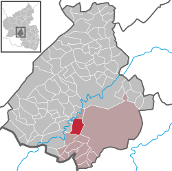 | ||
| Coordinates: 49°38′59″N 07°16′59″E / 49.64972°N 7.28306°ECoordinates: 49°38′59″N 07°16′59″E / 49.64972°N 7.28306°E | ||
| Country | Germany | |
| State | Rhineland-Palatinate | |
| District | Birkenfeld | |
| Municipal assoc. | Baumholder | |
| Government | ||
| • Mayor | Joachim Ritter | |
| Area | ||
| • Total | 11.13 km2 (4.30 sq mi) | |
| Elevation | 428 m (1,404 ft) | |
| Population (2017-12-31)[1] | ||
| • Total | 546 | |
| • Density | 49/km2 (130/sq mi) | |
| Time zone | CET/CEST (UTC+1/+2) | |
| Postal codes | 55776 | |
| Dialling codes | 06783 | |
| Vehicle registration | BIR | |
| Website | www.reichenbach-nahe.de | |

Reichenbach is an Ortsgemeinde – a municipality belonging to a Verbandsgemeinde, a kind of collective municipality – in the Birkenfeld district in Rhineland-Palatinate, Germany. It belongs to the Verbandsgemeinde of Baumholder, whose seat is in the like-named town.
Geography
Location
The municipality lies on the like-named brook, the Reichenbach, west of the 563 m-high Feldberg. The municipal area is 37.5% wooded.
Neighbouring municipalities
Reichenbach borders in the north on the municipality of Frauenberg, in the east on the Baumholder military drilling ground, in the south on the municipality of Ruschberg and in the west on the municipalities of Nohen and Kronweiler.
Constituent communities
Also belonging to Reichenbach are the outlying homesteads of Gerichtmannsmühle, Reichenbacherhöfe and Sonnenhof.[2]
Politics
Municipal council
The council is made up of 12 council members, who were elected by majority vote at the municipal election held on 7 June 2009, and the honorary mayor as chairman.[3]
Mayor
Reichenbach’s mayor is Joachim Ritter.[4]
Coat of arms
The municipality’s arms might be described thus: Per bend azure a bend sinister wavy between two millrinds palewise in bend, issuant from base a mount of three all argent, and chequy gules and argent.
The “chequy” field is a reference to the village’s former allegiance to the County of Sponheim.
Culture and sightseeing
Buildings
The following are listed buildings or sites in Rhineland-Palatinate’s Directory of Cultural Monuments:[5]
- Evangelical parish church, Kirchstraße 11 – Gothic Revival quarrystone aisleless church, 1863/1864, Municipal Master Builder Maßweiler, Sankt Wendel
- Auf dem Schoß 11 – stately estate complex along the street, 1879
- Between Hauptstraße 44 and 49 – warriors’ memorial for the victims of the First World War; stelelike, sandstone block with relief, design by Professor Renker, Trier, execution by F. Ritter and successors, after 1918
Economy and infrastructure
Transport
Running south of the village is the Autobahn A 62 (Kaiserslautern–Trier). Serving nearby Nohen is a railway station on the Nahe Valley Railway (Bingen–Saarbrücken).
References
- ↑ Statistisches Landesamt Rheinland-Pfalz "Bevölkerungsstand 2017 - Gemeindeebene" Check
|url=value (help). Statistisches Landesamt Rheinland-Pfalz (in German). 2018. - ↑ Statistisches Landesamt Rheinland-Pfalz – Amtliches Verzeichnis der Gemeinden und Gemeindeteile Archived 2015-11-25 at the Wayback Machine., Seite 18 (PDF)
- ↑ Kommunalwahl Rheinland-Pfalz 2009, Gemeinderat
- ↑ Reichenbach’s mayor
- ↑ Directory of Cultural Monuments in Birkenfeld district
External links