Reeder Township, Michigan
| Reeder Township, Michigan | |
|---|---|
| Township | |
 Reeder Township, Michigan Location within the state of Michigan | |
| Coordinates: 44°17′4″N 85°9′7″W / 44.28444°N 85.15194°WCoordinates: 44°17′4″N 85°9′7″W / 44.28444°N 85.15194°W | |
| Country | United States |
| State | Michigan |
| County | Missaukee |
| Area | |
| • Total | 34.9 sq mi (90.5 km2) |
| • Land | 34.9 sq mi (90.4 km2) |
| • Water | 0.0 sq mi (0.1 km2) |
| Elevation | 1,201 ft (366 m) |
| Population (2000) | |
| • Total | 1,112 |
| • Density | 31.9/sq mi (12.3/km2) |
| Time zone | UTC-5 (Eastern (EST)) |
| • Summer (DST) | UTC-4 (EDT) |
| ZIP codes |
49651 (Lake City), 49657 (McBain), 49632 (Falmouth) |
| FIPS code | 26-67840[1] |
| GNIS feature ID | 1626962[2] |
Reeder Township is a civil township of Missaukee County in the U.S. state of Michigan. As of the 2000 census, the township population was 1,112.
Communities
- The city of Lake City is situated at the northwest corner of the township along the east shore of Lake Missaukee and incorporates land in sections 6 and 7 of Reeder Township. Lake City was at first known as "Reeder", after Daniel Reeder, who built the first log cabin on what was then known as Lake Muskrat.[3] The Lake City post office, with ZIP code 49651, also serves the northern half of Reeder Township.[4]
- The city of McBain is to the south, and the McBain post office with ZIP code 49657 also serves much of southern Reeder Township.[5]
- The community of Falmouth is to the southeast, and the Falmouth post office with ZIP code 49531 also serves the southeast corner of Reeder Township.[6]
- Frey was a post office and a station on the Grand Rapids and Indiana Railroad at 44°18′35″N 85°09′18″W / 44.30972°N 85.15500°W. The post office operated from March 23, 1900 until June 15, 1903.[3][7]
Geography
According to the United States Census Bureau, the township has a total area of 34.9 square miles (90 km2), of which 34.9 square miles (90 km2) is land and 0.1 square miles (0.26 km2) (0.14%) is water.
Demographics
As of the census[1] of 2000, there were 1,112 people, 394 households, and 321 families residing in the township. The population density was 31.9 per square mile (12.3/km²). There were 535 housing units at an average density of 15.3 per square mile (5.9/km²). The racial makeup of the township was 97.03% White, 1.44% Native American, 0.09% Asian, 0.27% from other races, and 1.17% from two or more races. Hispanic or Latino of any race were 1.35% of the population.
There were 394 households out of which 39.3% had children under the age of 18 living with them, 71.1% were married couples living together, 5.8% had a female householder with no husband present, and 18.5% were non-families. 14.5% of all households were made up of individuals and 5.3% had someone living alone who was 65 years of age or older. The average household size was 2.82 and the average family size was 3.08.
In the township the population was spread out with 30.3% under the age of 18, 7.7% from 18 to 24, 28.7% from 25 to 44, 21.4% from 45 to 64, and 11.9% who were 65 years of age or older. The median age was 34 years. For every 100 females, there were 109.4 males. For every 100 females age 18 and over, there were 106.1 males.
The median income for a household in the township was $33,424, and the median income for a family was $35,192. Males had a median income of $30,417 versus $19,583 for females. The per capita income for the township was $13,962. About 7.7% of families and 10.6% of the population were below the poverty line, including 9.3% of those under age 18 and 15.3% of those age 65 or over.
References
- 1 2 "American FactFinder". United States Census Bureau. Retrieved 2008-01-31.
- ↑ U.S. Geological Survey Geographic Names Information System: Reeder Township, Michigan
- 1 2 Romig, Walter (1986) [1973]. Michigan Place Names. Detroit, Michigan: Wayne State University Press. ISBN 0-8143-1838-X.
- ↑ 49651 5-Digit ZCTA, 496 3-Digit ZCTA - Reference Map - American FactFinder, U.S. Census Bureau, 2000 census
- ↑ 49657 5-Digit ZCTA, 496 3-Digit ZCTA - Reference Map - American FactFinder, U.S. Census Bureau, 2000 census
- ↑ 49632 5-Digit ZCTA, 496 3-Digit ZCTA - Reference Map - American FactFinder, U.S. Census Bureau, 2000 census
- ↑ U.S. Geological Survey Geographic Names Information System: Frey, Michigan
Municipalities and communities of Missaukee County, Michigan, United States | ||
|---|---|---|
| Cities | 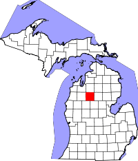 | |
| Townships | ||
| CDP | ||
| Unincorporated communities | ||