Jennings, Michigan
| Jennings, Michigan | |
|---|---|
| Census-designated place | |
 Jennings, Michigan  Jennings, Michigan | |
| Coordinates: 44°19′58″N 85°17′53″W / 44.33278°N 85.29806°WCoordinates: 44°19′58″N 85°17′53″W / 44.33278°N 85.29806°W | |
| Country | United States |
| State | Michigan |
| County | Missaukee |
| Area[1] | |
| • Total | 0.760 sq mi (1.97 km2) |
| • Land | 0.759 sq mi (1.97 km2) |
| • Water | 0.001 sq mi (0.003 km2) |
| Elevation | 1,306 ft (398 m) |
| Population (2010)[1] | |
| • Total | 264 |
| • Density | 350/sq mi (130/km2) |
| Time zone | UTC-5 (Eastern (EST)) |
| • Summer (DST) | UTC-4 (EDT) |
| Area code(s) | 231 |
| GNIS feature ID | 629259[2] |
Jennings is an unincorporated community and census-designated place in Lake Township, Missaukee County, Michigan, United States. Its population was 264 as of the 2010 census.[1]
Geography
According to the U.S. Census Bureau, the community has an area of 0.760 square miles (1.97 km2), of which 0.759 square miles (1.97 km2) is land and 0.001 square miles (0.0026 km2) is water.[1]
History
Jennings was a lumbering center founded by Austin and William Mitchell, who named it for William Jennings Bryan. A post office opened on March 8, 1883, with J. Frank Schryer as the first postmaster. The office was discontinued on July 31, 1956. Jennings was a terminus of the Missukee spur of the Grand Rapids and Indiana Railroad, with a junction on the main line named Round Lake.[3] [4]
References
- 1 2 3 4 "2010 Census Gazetteer Files - Places: Michigan". U.S. Census Bureau. Retrieved May 6, 2018.
- ↑ "Jennings". Geographic Names Information System. United States Geological Survey.
- ↑ U.S. Geological Survey Geographic Names Information System: Jennings Post Office (historical)
- ↑ Romig, Walter (1986) [1973]. Michigan Place Names. Detroit, Michigan: Wayne State University Press. ISBN 0-8143-1838-X.
Municipalities and communities of Missaukee County, Michigan, United States | ||
|---|---|---|
| Cities | 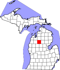 | |
| Townships | ||
| CDP | ||
| Unincorporated communities | ||