Red Sucker Lake Airport
| Red Sucker Lake Airport | |||||||||||
|---|---|---|---|---|---|---|---|---|---|---|---|
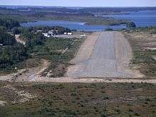 Runway 26 (now 27), short final | |||||||||||
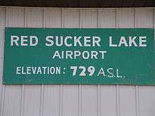 Old elevation sign | |||||||||||
| Summary | |||||||||||
| Airport type | Public | ||||||||||
| Operator | Government of Manitoba | ||||||||||
| Location | Red Sucker Lake, Manitoba | ||||||||||
| Time zone | CST (UTC−06:00) | ||||||||||
| • Summer (DST) | CDT (UTC−05:00) | ||||||||||
| Elevation AMSL | 745 ft / 227 m | ||||||||||
| Coordinates | 54°10′03″N 093°33′27″W / 54.16750°N 93.55750°WCoordinates: 54°10′03″N 093°33′27″W / 54.16750°N 93.55750°W | ||||||||||
| Map | |||||||||||
 CYRS Location in Manitoba | |||||||||||
| Runways | |||||||||||
| |||||||||||
| Statistics (2010) | |||||||||||
| |||||||||||
Red Sucker Lake Airport, (IATA: YRS, ICAO: CYRS), is located adjacent to Red Sucker Lake, Manitoba, Canada.
Airlines and destinations
| Airlines | Destinations |
|---|---|
| Perimeter Aviation | Garden Hill, Winnipeg |
See also
References
- ↑ Canada Flight Supplement. Effective 0901Z 19 July 2018 to 0901Z 13 September 2018.
- ↑ Total aircraft movements by class of operation
| By name | |
|---|---|
| By location indicator | |
| By province/territory | |
| By area | |
| National Airports System | |
| Related | |
| |
This article is issued from
Wikipedia.
The text is licensed under Creative Commons - Attribution - Sharealike.
Additional terms may apply for the media files.