Red Devil, Alaska
| Red Devil, Alaska | |
|---|---|
| CDP | |
 | |
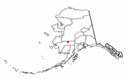 Location of Red Devil, Alaska | |
| Coordinates: 61°46′41″N 157°20′54″W / 61.77806°N 157.34833°WCoordinates: 61°46′41″N 157°20′54″W / 61.77806°N 157.34833°W | |
| Country | United States |
| State | Alaska |
| Census Area | Bethel |
| Government | |
| • State senator | Lyman Hoffman (D) |
| • State rep. | Bryce Edgmon (D) |
| Area | |
| • Total | 26.4 sq mi (68.3 km2) |
| • Land | 24.2 sq mi (62.6 km2) |
| • Water | 2.2 sq mi (5.7 km2) |
| Population (2010) | |
| • Total | 23 |
| • Density | .9/sq mi (0.3/km2) |
| Time zone | UTC-9 (Alaska (AKST)) |
| • Summer (DST) | UTC-8 (AKDT) |
| ZIP code | 99656 |
| Area code(s) | 907 |
| FIPS code | 02-64930 |
| GNIS ID | 2419198[1] |
Red Devil is a census-designated place (CDP) in Bethel Census Area, Alaska, United States. The population was 23 at the 2010 census, down from 48 in 2000. Their post office was founded in 1957 [2]
History
The village was named after the Red Devil Mine, established in 1921 by Hans Halverson when numerous mercury (quicksilver) deposits were discovered in the surrounding Kilbuck-Kuskokwim Mountains. By 1933, the mine was producing substantial quantities of mercury. Although the mine changed ownership twice over the years, it continued to operate until 1971.[3]
Geography
According to the United States Census Bureau, the CDP has a total area of 26.4 square miles (68 km2), of which, 24.2 square miles (63 km2) of it is land and 2.2 square miles (5.7 km2) of it (8.34%) is water.[4]
Demographics
| Historical population | |||
|---|---|---|---|
| Census | Pop. | %± | |
| 1960 | 152 | — | |
| 1970 | 81 | −46.7% | |
| 1980 | 39 | −51.9% | |
| 1990 | 53 | 35.9% | |
| 2000 | 48 | −9.4% | |
| 2010 | 23 | −52.1% | |
| U.S. Decennial Census[5] | |||
Red Devil first appeared on the 1960 U.S. Census as an unincorporated village. In 1980, it was made a census-designated place (CDP).
As of the census [6] of 2010, there were 23 people, 12 occupied households, residing in the CDP. The population density was 1.9 people per square mile (0.8/km²). There were 22 housing units at an average density of 0.9/sq mi (0.4/km²). The racial makeup of the CDP was 17.4% White, 43.5% Native American, and 39.1% from two or more races. The population was spread out with 2 people under the age of 14, 2 people 15 to 19 and the remaining 19 people were 25 or older. The median income for a household for 2009 in the CDP was $59,886. 40.4% of the population lives beneath the poverty line.
See also
References
- ↑ U.S. Geological Survey Geographic Names Information System: Red Devil, Alaska
- ↑ http://webpmt.usps.gov/pmt003.cfm%5Bpermanent+dead+link%5D
- ↑ "Alaska Community Database Community Information Summaries (CIS)". Retrieved September 26, 2012.
- ↑ "Archived copy". Archived from the original on 2012-01-24. Retrieved 2012-06-24.
- ↑ "U.S. Decennial Census". Census.gov. Retrieved June 6, 2013.
- ↑ http://factfinder2.census.gov/faces/tableservices/jsf/pages/productview.xhtml?pid=DEC_10_DP_DPDP1&prodType=table
External links
Municipalities and communities of Bethel Census Area, Alaska, United States | ||
|---|---|---|
| Cities | 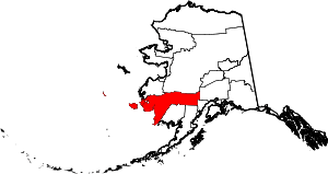 | |
| CDPs | ||
| Unincorporated communities | ||
| Ghost towns | ||