Ray Promontory
Location of Byers Peninsula, Livingston Island in the South Shetland Islands.

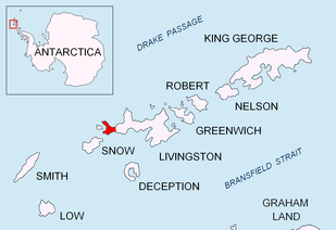
Topographic map of Livingston Island and Smith Island.
Ray Promontory is the 7 km long and 2.8 km wide promontory lying between Barclay Bay and the New Plymouth sound, and forming the northwest part of Byers Peninsula, Livingston Island in the South Shetland Islands, Antarctica ending up in Start Point and Essex Point. The promontory's interior is mostly occupied by Dospey Heights.
The feature is named after the American Captain Nathaniel Ray, Master of the sealing schooner Harmony which operated in the islands in 1820-21 .
Location
The promontory is centred at 62°36′00″S 61°08′40″W / 62.60000°S 61.14444°W (British mapping in 1968, detailed Spanish mapping in 1992, and Bulgarian mapping in 2005 and 2009).
Maps
- Península Byers, Isla Livingston. Mapa topográfico a escala 1:25000. Madrid: Servicio Geográfico del Ejército, 1992.
- L.L. Ivanov et al. Antarctica: Livingston Island and Greenwich Island, South Shetland Islands. Scale 1:100000 topographic map. Sofia: Antarctic Place-names Commission of Bulgaria, 2005.
- L.L. Ivanov. Antarctica: Livingston Island and Greenwich, Robert, Snow and Smith Islands. Scale 1:120000 topographic map. Troyan: Manfred Wörner Foundation, 2009. ISBN 978-954-92032-6-4
- Antarctic Digital Database (ADD). Scale 1:250000 topographic map of Antarctica. Scientific Committee on Antarctic Research (SCAR). Since 1993, regularly upgraded and updated.
- L.L. Ivanov. Antarctica: Livingston Island and Smith Island. Scale 1:100000 topographic map. Manfred Wörner Foundation, 2017. ISBN 978-619-90008-3-0
References
This article is issued from
Wikipedia.
The text is licensed under Creative Commons - Attribution - Sharealike.
Additional terms may apply for the media files.