Dospey Heights
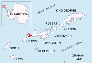

Dospey Heights (Bulgarian: Доспейски възвишения, ‘Dospeyski Vazvisheniya’ \do-'spey-ski va-zvi-'she-ni-ya\) are the ice-free heights on Ray Promontory in the northwestern part of Byers Peninsula on Livingston Island in the South Shetland Islands, Antarctica. Extending 6 km southeastwards from Essex Point and Start Point, and 2.6 km wide. Rising to 265 m at Start Hill.
The heights are named after the settlement of Dospey in Rila Mountain, southwestern Bulgaria.
Location
Dospey Heights are centred at 62°35′50″S 61°08′25″W / 62.59722°S 61.14028°WCoordinates: 62°35′50″S 61°08′25″W / 62.59722°S 61.14028°W. British mapping in 1968, Spanish in 1991 and 1993 and Bulgarian in 2005 and 2009.
Maps
- Península Byers, Isla Livingston. Mapa topográfico a escala 1:25000. Madrid: Servicio Geográfico del Ejército, 1992.
- L.L. Ivanov et al. Antarctica: Livingston Island and Greenwich Island, South Shetland Islands. Scale 1:100000 topographic map. Sofia: Antarctic Place-names Commission of Bulgaria, 2005.
- L.L. Ivanov. Antarctica: Livingston Island and Greenwich, Robert, Snow and Smith Islands. Scale 1:120000 topographic map. Troyan: Manfred Wörner Foundation, 2010. ISBN 978-954-92032-9-5 (First edition 2009. ISBN 978-954-92032-6-4)
- South Shetland Islands: Livingston Island, Byers Peninsula. Scale 1:50000 satellite map. UK Antarctic Place-names Committee, 2010.
- Antarctic Digital Database (ADD). Scale 1:250000 topographic map of Antarctica. Scientific Committee on Antarctic Research (SCAR). Since 1993, regularly updated.
- L.L. Ivanov. Antarctica: Livingston Island and Smith Island. Scale 1:100000 topographic map. Manfred Wörner Foundation, 2017. ISBN 978-619-90008-3-0
References
- Dospey Heights. SCAR Composite Gazetteer of Antarctica.
- Bulgarian Antarctic Gazetteer. Antarctic Place-names Commission. (details in Bulgarian, basic data in English)
This article includes information from the Antarctic Place-names Commission of Bulgaria which is used with permission.