Rauchenwarth
| Rauchenwarth | ||
|---|---|---|
| ||
 Rauchenwarth Location within Austria | ||
| Coordinates: 48°06′00″N 16°31′00″E / 48.10000°N 16.51667°ECoordinates: 48°06′00″N 16°31′00″E / 48.10000°N 16.51667°E | ||
| Country | Austria | |
| State | Lower Austria | |
| District | Bruck an der Leitha | |
| Government | ||
| • Mayor | Ernst Schüller (ÖVP) | |
| Area | ||
| • Total | 13.4 km2 (5.2 sq mi) | |
| Elevation | 206 m (676 ft) | |
| Population (1 January 2016)[1] | ||
| • Total | 707 | |
| • Density | 53/km2 (140/sq mi) | |
| Time zone | UTC+1 (CET) | |
| • Summer (DST) | UTC+2 (CEST) | |
| Postal code | 2320 | |
| Area code | 02230 | |
| Vehicle registration | BL | |
| Website | www.rauchenwarth.gv.at | |

Rauchenwarth is a municipality in the district of Bruck an der Leitha in the Austrian state of Lower Austria. It belonged to Wien-Umgebung District which was dissolved at the end of 2016.[2][3]
Population
| Historical population | ||
|---|---|---|
| Year | Pop. | ±% |
| 1971 | 474 | — |
| 1981 | 468 | −1.3% |
| 1991 | 514 | +9.8% |
| 2001 | 602 | +17.1% |
References
- ↑ Statistik Austria - Bevölkerung zu Jahresbeginn 2002-2016 nach Gemeinden (Gebietsstand 1.1.2016) for Rauchenwarth.
- ↑ http://www.noen.at/nachrichten/noe/politik-bildung/Bezirk-Wien-Umgebung-wird-aufgeloest;art79519,667302
- ↑ "Wien-Umgebung: Aufteilung geändert", artikel in Niederösterreichische Nachrichten (NÖN.at), 24-9-2015
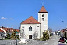
Center of Rauchenwarth with parish church
This article is issued from
Wikipedia.
The text is licensed under Creative Commons - Attribution - Sharealike.
Additional terms may apply for the media files.