Rato (Lisbon Metro)
 | |||||||||||
| Location |
Largo do Rato, Lisbon | ||||||||||
| Coordinates | 38°43′12″N 9°9′21″W / 38.72000°N 9.15583°WCoordinates: 38°43′12″N 9°9′21″W / 38.72000°N 9.15583°W | ||||||||||
| Owned by | Government-owned corporation | ||||||||||
| Operated by | Metropolitano de Lisboa, EPE | ||||||||||
| Line(s) |
| ||||||||||
| Platforms | 2 side platforms | ||||||||||
| Tracks | 2 | ||||||||||
| Construction | |||||||||||
| Structure type | Underground | ||||||||||
| Disabled access | Yes | ||||||||||
| Architect | Sanchez Jorge | ||||||||||
| Other information | |||||||||||
| Station code | RA | ||||||||||
| Fare zone | L | ||||||||||
| History | |||||||||||
| Opened | 29 December 1997 | ||||||||||
| Services | |||||||||||
| |||||||||||
| |||||||||||||||||||||||||||||||||||||||||||||||||||||||||||||||||||||||||||||||||||||||||||||||||||||||||||||||||||||
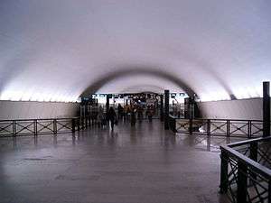
Rato station is the southern terminus of the Yellow Line of the Lisbon Metro. It opened on 29 December 1997 and it is located on Largo do Rato. The architectural design of the station is by Sanchez Jorge.[1]
Connections
Urban Buses

- 202 Cais do Sodré ⇄ Bairro Padre Cruz
- 706 Cais do Sodré ⇄ Estação Santa Apolónia
- 706 Restauradores ⇄ Campo de Ourique (Prazeres)
- 713 Alameda D. A. Henriques ⇄ Estação Campolide
- 720 Picheleira/Rua Faria Vasconcelos ⇄ Calvário
- 727 Estação Roma-Areeiro ⇄ Restelo - Av. das Descobertas
- 738 Quinta dos Barros ⇄ Alto de Santo Amaro
- 758 Cais do Sodré ⇄ Portas de Benfica
- 774 Campo de Ourique (Prazeres) ⇄ Gomes Freire[2]
See also
References
- ↑ "Rato". Metropolitano de Lisboa (in Portuguese). Transportes de Lisboa de Lisboa.
- ↑ Seara.com. "http://www.carris.pt/en/home/". www.carris.pt. Retrieved 2017-07-16. External link in
|title=(help)
External links
![]()
This article is issued from
Wikipedia.
The text is licensed under Creative Commons - Attribution - Sharealike.
Additional terms may apply for the media files.