Rapid City, Michigan
| Rapid City, Michigan | |
|---|---|
| Census-designated place | |
 Rapid City, Michigan  Rapid City, Michigan | |
| Coordinates: 44°50′04″N 85°16′57″W / 44.83444°N 85.28250°WCoordinates: 44°50′04″N 85°16′57″W / 44.83444°N 85.28250°W | |
| Country | United States |
| State | Michigan |
| County | Kalkaska |
| Area[1] | |
| • Total | 5.498 sq mi (14.24 km2) |
| • Land | 5.408 sq mi (14.01 km2) |
| • Water | 0.090 sq mi (0.23 km2) |
| Elevation | 630 ft (190 m) |
| Population (2010)[1] | |
| • Total | 1,352 |
| • Density | 250/sq mi (95/km2) |
| Time zone | UTC-5 (Eastern (EST)) |
| • Summer (DST) | UTC-4 (EDT) |
| Area code(s) | 231 |
| GNIS feature ID | 635648[2] |
Rapid City is an unincorporated community and census-designated place in Clearwater Township, Kalkaska County, Michigan, United States. Its population was 1,352 as of the 2010 census.[1] The community is located on the Rapid River.
Geography
According to the U.S. Census Bureau, the community has an area of 5.498 square miles (14.24 km2), of which 5.408 square miles (14.01 km2) is land and 0.090 square miles (0.23 km2) is water.[1]
References
- 1 2 3 4 "2010 Census Gazetteer Files - Places: Michigan". U.S. Census Bureau. Retrieved June 1, 2018.
- ↑ "Rapid City". Geographic Names Information System. United States Geological Survey.
Municipalities and communities of Kalkaska County, Michigan, United States | ||
|---|---|---|
| Village | 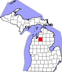 | |
| Townships | ||
| CDPs | ||
This article is issued from
Wikipedia.
The text is licensed under Creative Commons - Attribution - Sharealike.
Additional terms may apply for the media files.