Ranjangaon Sandas
| Ranjangaon Sandas रांजणगाव सांडस | |
|---|---|
| village | |
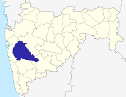
 Ranjangaon Sandas Location in Maharashtra, India  Ranjangaon Sandas Ranjangaon Sandas (India) | |
| Coordinates: 18°34′19″N 074°20′41″E / 18.57194°N 74.34472°ECoordinates: 18°34′19″N 074°20′41″E / 18.57194°N 74.34472°E | |
| Country |
|
| State | Maharashtra |
| District | Pune |
| Taluka | Shirur |
| Government | |
| • Body | Gram panchayat |
| Population (2001) | |
| • Total | 3,593 |
| Languages | |
| • Official | Marathi |
| Time zone | UTC+5:30 (IST) |
| PIN | 412211 |
| ISO 3166 code | IN-MH |
| Vehicle registration | MH |
| Lok Sabha constituency | Shirur |
| Vidhan Sabha constituency | Shirur |
| Website |
pune |
Ranjangaon Sandas (Mr:रांजणगाव सांडस) is a panchayat village[1] in the state of Maharashtra, India,[2][3] on the left (east) bank of the Bhima River just above its intersection with the Mula-Mutha River.[4] Administratively, Ranjangaon Sandas is under Shirur Taluka of Pune District in Maharashtra.[3] The village of Ranjangaon Sandas is 5.5 km by road south of the village of Alegaon Paga, and 38 km by road south of the town of Shirur.
There are two villages in the Ranjangaon Sandas gram panchayat: Ranjangaon Sandas and Rakshewadi (Rakshevadi).[3] Rakshewadi is located just over 2 km north of Ranjangaon Sandas.[4]
Demographics
In the 2001 census, the village of Ranjangaon Sandas had 3,593 inhabitants, with 1,856 males (51.6%) and 1,737 females (48.4%), for a gender ratio of 936 females per thousand males.[5]
Education
Zilha parishad school up 7th standard. Ranjangaon Sandas has a secondary school: Shri. Santraj Maharaj Vidyalaya. this vidyalaya was established by Dr. Shantaram Vaman Randive.
Notes
- ↑ 2011 Village Panchayat Code for Ranjangaon Sandas = 188613, "Reports of National Panchayat Directory: Village Panchayat Names of Shirur, Pune, Maharashtra". Ministry of Panchayati Raj, Government of India. Archived from the original on 2013-05-11.
- ↑ 2001 Census Village code for Ranjangaon Sandas = 03052300, "2001 Census of India: List of Villages by Tehsil: Maharashtra" (PDF). Registrar General & Census Commissioner, India. p. 593. Archived (PDF) from the original on 13 November 2011.
- 1 2 3 2011 Census Village code for Ranjangaon Sandas = 555652, "Reports of National Panchayat Directory: List of Census Villages mapped for: Ranjangaon Sandas Gram Panchayat, Shirur, Pune, Maharashtra". Ministry of Panchayati Raj, Government of India.
- 1 2 Poona India, Sheet NE 43-06 (topographic map, scale 1:250,000), Series U-502, United States Army Map Service, May 1960
- ↑ "Census 2001 Population Finder: Maharashtra: Pune: Shirur: Ranjangaon Sandas". Office of The Registrar General & Census Commissioner, Ministry of Home Affairs, Government of India.
External links
- "Official Website of Pune District".
- "Delimitation of PC and AC - 2004 Shirur Taluka, Pune District, Maharashtra (Administrative Units)". Pune District. Archived from the original (Map) on 2012-03-07.
Pune district topics | ||||||||||||||||||
|---|---|---|---|---|---|---|---|---|---|---|---|---|---|---|---|---|---|---|
| History |
| |||||||||||||||||
| Geography |
| |||||||||||||||||
| Cities and towns |
| |||||||||||||||||
| Transport | ||||||||||||||||||
| Culture | ||||||||||||||||||
| Constituencies |
| |||||||||||||||||