Ranhat
| Ranhat রণহাট গড়ের হাট (পূর্বে) | |
|---|---|
| Village | |
| Land of Ponds | |
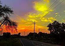
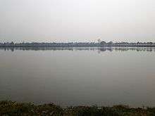
 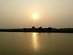 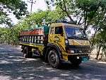 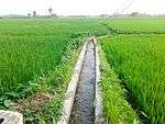 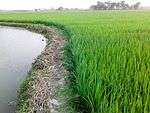 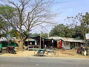 Clockwise from top: Maps of Harian Union, A Sunset in Ranhat Bado Beel, Transportation through Ranhat Bypass, Irritations from Deep Water Pump, Green Paddy Fields and Ranhat Ashraaf-er Mohr | |
| Nickname(s): Land of Ponds | |
 Ranhat Location of Ranhat in Rajshahi | |
| Coordinates: 24°23′N 88°41′E / 24.39°N 88.69°ECoordinates: 24°23′N 88°41′E / 24.39°N 88.69°E | |
| Country |
|
| Division | Rajshahi Division |
| District | Rajshahi District |
| Upazila | Paba Upazila |
| Thana | Motihar |
| Union | 8 No. Harian Union Parishod |
| Ward No. | 01 |
| Established | 1953 (Approximately) |
| Battle of Ranhat | 1960 |
| Government | |
| • Type | Union Parishod |
| • U.P. Member | Nurul Islam |
| Area | |
| • Total | 1 km2 (0.4 sq mi) |
| Population | |
| • Total | 3,215 |
| • Density | 3,200/km2 (8,300/sq mi) |
| • Literacy Rate | 43.62% |
| • Economic Solvency | Fishery and poultry farming |
| Time zone | UTC+6 (BST) |
| Postal code | 6211 |
| Road | N603 |
| Language | Bengali |
| Religion |
Muslim: 97.49% Others: 2.51% |
|
According to the total area of ponds and lakes, Ranhat is one of the largest village in 8 No. Harian Union. Most viewed landscapes are- ✡ Ranhat Bado Beel ✡ Ranhat Bado Dighi ✡ Ranhat Rano Dighi ✡ Ranhat Khulu Beel ✡ Ranhat Padma Beel | |
Ranhat (Bengali: রণহাট) is a village of 8 No. Harian Union of Paba Upazila, Rajshahi, Bangladesh.
History
Ranhat was established in 1953 according to the way of traditional and cultural mutuality among the villagers of Ranhat. Before it is named Ranhat, the entire locality was first founded as a Bazaar. In 1960, a conflict between two groups arose as a result of a conflict in the fishing process. Almost 3 or 4 people had died and many were seriously injured. In earlier years, the major changes in Ranhat were as a result of unity, corresponding services, and social development. Before it was named Ranhat, people called it "Gorer Haat" since its inception. A few years ago, there was a trade marketing association next to Ranhat Bypass. Now some bamboo wares have settled up there.
The village is included in 8 No. Harian Union Parishod which is now combined with nine wards and 12 mouzas.
Geography
Ranhat is located at 24°23′41″N 88°41′07″E / 24.3946413°N 88.6853844°E[1] with a total area of 1 km2 (0.39 sq mi) and is situated in the north-east of Rajshahi city and north from Harian Union. Ranhat is divided into eleven territory localities with two main areas which are called Ranhat east and Ranhat west. The major part of Ranhat exists in Eastside. Two-thirds of the population lives on the east side of Ranhat. Also, there exists two localities-one is called Namu Para which is situated on the very west side of Rano Dighi and another is Sheikh Para which is situated on the east side. Padma Beel, Rano Dighi, Bado Dighi, Hamur Dighi etc. are laid on the east side. Khulu Beel is the only lake situated on the west side. Rajshahi Bypass has overcome Ranhat with one-quarter of the total distance. One quarter of the total paving and semi paving roads are outstretched over the boundary. Most of the lands are arable for cultivating paddy, wheat, pulses and other necessary crops during all seasons. There is a fertilizer plant along Ranhat.
Demographics
At the 2011 Bangladesh census, Ranhat had a population of 3,216 of which males constituted 48.15% and females 51.85%.[2] 1374 were over the age of 18, and the average literacy rate was 43.62% (7+ years), compared to the national average of 36.32%. Ranhat has recently been developed in educational perspectives. Children go to school at all ages in Ranhat. Almost every resident in Ranhat is Bengali people, as is the case in most of Bangladesh. People generally speak in Bengali, the national language. Many distinctive Bengali dialects and regional languages are also spoken. English is understood by a few numbers of the total population, especially for study purposes. Islam is a major religion, approximately 97.49% people are Muslim, and the rest of them are Hindus and others.[3]
Points of interest
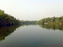
There are small and large sized ponds such as Ranhat Bado Beel, Bado Dighi, Rano Dighi, Khulu Beel, Moji Pukur, Hamur Dighi, Padma Beel and many more small canals.
Ranhat Boro Dighi
Boro Dighi (বড় দিঘী) is one of the most popular lakes and a public place in Ranhat. It is located on the left side of Rajshahi Bypass road at N603. The whole area is almost 6.2 acres of land. There is a myth about Boro Dighi that an ancient ruler in Ranhat once propounded a model to dig a pond through a mysterious horse racing. He disclosed to have horse race as far as the horse would run over the meadow would be appointed to dig from that longitude. While racing, unfortunately, the horse had failed apart from the distance to run in the overshoot and that running area dug by many of laborers. There are four main verges; the broader verges are at the north-south which have a long distance and the narrower verges are at the east-west side. Now, the south and north verges are disrupting gradually. The fringes of the pond are covered with bamboo forest and densest trees. It fills with water almost in all seasons. To pass a leisure time, most often people gather here. Various kinds of fishes are cultivated in this lake. There are some sitting pillars set on the south verge.
Ranhat Boro Beel
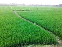
Boro Beel is the largest lake in Ranhat. The whole area enlarges to the border with the coverage of three villages-Nalkhola, Parila and Mahindra. Two thirds of the total area of Ranhat are distributed in Boro Beel. Most of its land has been suggested as some deep lakes for fisheries and aquatic plants. Boro Beel contains a lot of ponds and cultivated lands as a whole. Farmers grow different types of crops in all seasons in the swamp. In rainy season, Boro Beel brims with water and lots of fishes are caught by the fishermen. There are several deep water pumps laid to irrigate crops and fields during summer. Natural view of this place is called the land of ponds.
Ranhat Rano Dighi
Rano Dighi is established about in 1960 after the battle of Ranhat. Before it, it was a lake included in Bado Beel. Rano Dighi is the entrance of Bado Beel and another attraction for its imposing beauty.
Ranhat Ashraaf-er Morh
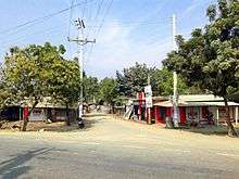
As Ranhat is famous for various ponds and cultivated lands in whole Harian Union and Upazila, so their main economic growth mostly depends on fisheries, agricultural resources, and products. Ashraaf-er Morh is a common trade place where all the daily activities directly within the territory countryside which is next to Rajshahi Bypass N603. Groceries, green stuff, greengrocer, fluttered, raw materials, poultry, and fish feed, building structural materials etc. are the main vaults to deal among villagers which play a vital role to elevate economical movement. Most of the villagers depend on fishing, agriculture, and farming. All daily needed types of equipment are traded here in Ashraaf-er Morh. There are a few storehouses, tea stalls, dispensaries, farmhouses and aquatic centers. Young people are self-reliant and self-assured in their symmetry.
Ranhat Padma Beel
Ranhat Padma Beel is the largest lake in Harian Union. Its west side has spread Mollikpur over the main area. All verges of this dry lake are covered with houses and huts. The lake only submerges into the water during the rainy season but in other seasons, the lake remains dry and fertile. Farmers grow different crops during the summer on Padma Beel.
Ranhat Khulu Beel

Another largest lake Khulu Beel is situated on the west side of Ranhat with 11.2 acres of whole surrounding area. Khulu Beel consists of two parts-one is a lake and another is agricultural land. The lake is suitable for cultivation of fishes. There is a small boat in Khulu Beel to look after the area. All verges of this lake are covered with green trees and shade of localities. This lake has used as an extra attraction for tourists.
The agricultural lands situated by the bank of the lake are also known as Khulu Beel. A large number of crops are harvested from this land. There are some alternative systems for irrigation during summer and dry season.
Archaeological ruins
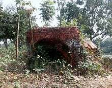
There is an archaeological site situated in Ranhat East Side near Padma Beel. A small bricked structure is placed on the entire wall. There is an entrance towards the west side. The height is of 6 feet taller from its top to bottom. Also, there is a pond near its back. It is uttered that the dome was once used for a cake baking room in ancient times. Trace of this little-bricked archive gives a clear understanding of the age.
Education
All children in Ranhat have a strong eagerness to go to school although there are no educational institutions in this village. A Madrasa is the only place for learning Arabic. Annual growth of total population is 1.80% and the literacy rate is 43.62%[4] of which men constituted 51.8% and women 48.8%. There is a central mosque situated in Ashraaf-er Mohr and four insignificant mosques scattered around the village. Furthermore, there is a government educational organization named Masjid Vittik Shishu O Gano Shikhsha Karyakram[5] for pre-primary education and training in Ranhat.
There is a high school named MRK High School at the west end of Ranhat in the collectivism with three villages-Mallikpur, Ranhat, and Kukhandi. All the activities, administrations of this school are conducted by three chairpersons of these three villages. Junior school certificate and secondary school certificate are given to each student from this school every year if they pass on respectively JSC and SSC examination. There are 19 academic staffs and almost 1000 students from class VI to class X. There is also a college which is conducted by three villages too. Recently the college has started achieving some responsibilities with necessary education training for both students enrolled or not.
Development

A lot of developing sources such as fishing, poultry farming, agriculture, business, enterprises, labor etc. play an important role in early development in recent years. Peoples' main economic resources depend on agriculture and fisheries. According to the statistics from the last couple of years, poultry farming has increased with an aggressive rate in Ranhat. The graph shows statically a very early increasing development in both agriculture and farming sector. Huge amount of profit, less marginal cost and less travail drive people to cultivate poultries thoroughly. Family planning, ecology, mutuality of social activities, proper guidance are the stair of economic development.
References
- ↑ "Maps of Google, Google Inc.".
- ↑ 2011 Census of Bangladesh
- ↑ Sources of Data, Regional Collaboration. "A sample survey of Population Distribution of Ranhat, Rajshahi Sugar Mills-6211, Paba Upazila, Rajshahi".
- ↑ Demographic, Yearbook (2011). "Demographic Yearbook" – via 8 No. Harian Union Parishod Council, Paba, Rajshahi.
- ↑ "A government organisation for child education". Ranhat, 8 No. Harian Union, Paba Upazila, Rajshahi.
![]()