Rangersdorf
| Rangersdorf | ||
|---|---|---|
| ||
 Rangersdorf Location within Austria | ||
| Coordinates: 46°52′N 12°58′E / 46.867°N 12.967°ECoordinates: 46°52′N 12°58′E / 46.867°N 12.967°E | ||
| Country | Austria | |
| State | Carinthia | |
| District | Spittal an der Drau | |
| Government | ||
| • Mayor | Franz Zlöbl | |
| Area | ||
| • Total | 84.27 km2 (32.54 sq mi) | |
| Elevation | 864 m (2,835 ft) | |
| Population (1 January 2016)[1] | ||
| • Total | 1,737 | |
| • Density | 21/km2 (53/sq mi) | |
| Time zone | UTC+1 (CET) | |
| • Summer (DST) | UTC+2 (CEST) | |
| Postal code | 9833 | |
| Area code | 04823 | |
| Website | www.rangersdorf.at | |

Rangersdorf is a town in the district of Spittal an der Drau in Carinthia in Austria.
Geography
Rangersdorf lies in the Möll valley between the Goldberg group and the Kreuzeck on the south.
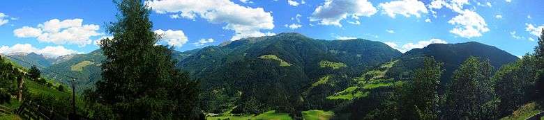
Looking across the Mölltal from Rangersdorf
References
This article is issued from
Wikipedia.
The text is licensed under Creative Commons - Attribution - Sharealike.
Additional terms may apply for the media files.