Ramot Meir
| Ramot Meir רָמוֹת מֵאִיר | |
|---|---|
 | |
 Ramot Meir | |
| Coordinates: 31°52′26.75″N 34°51′19.07″E / 31.8740972°N 34.8552972°ECoordinates: 31°52′26.75″N 34°51′19.07″E / 31.8740972°N 34.8552972°E | |
| District | Central |
| Council | Gezer |
| Affiliation | Moshavim Movement |
| Founded | 1949 |
| Founded by | Demobilised soldiers |
| Population (2017)[1] | 748 |
| Website | ramotmeir.co.il |
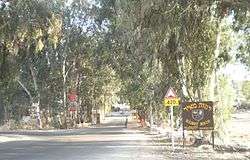
Ramot Meir (Hebrew: רָמוֹת מֵאִיר, lit. Meir Heights) is a small moshav in central Israel. Located in the Shephelah around four kilometres south of Rehovot, it falls under the jurisdiction of Gezer Regional Council. In 2017 it had a population of 748.[1]
History
The moshav was founded in 1949 by demobilised soldiers, and was named after the American philanthropist Meyer Rosoff. Rosoff had bought the land around the Palestinian village of al-Na'ani in the 1930s for his company, Rosoff Group Plantations.[2] After the 1948 war, it expanded on part of the remaining al-Na'ani land.[3]
It collapsed in 1965, but was re-established in 1969 by a group of immigrants from France (who had originally moved there from North Africa)
References
- 1 2 "List of localities, in Alphabetical order" (PDF). Israel Central Bureau of Statistics. Retrieved August 26, 2018.
- ↑ Glass, J.B. (2002) From New Zion to Old Zion: American Jewish Immigration and Settlement Wayne State University Press, pp238-239, ISBN 0-8143-2842-3
- ↑ Khalidi, W. (1992). All That Remains: The Palestinian Villages Occupied and Depopulated by Israel in 1948. Washington D.C.: Institute for Palestine Studies. p. 400. ISBN 0-88728-224-5.
External links
| Wikimedia Commons has media related to Ramot Meir. |
- Official website (in Hebrew)
This article is issued from
Wikipedia.
The text is licensed under Creative Commons - Attribution - Sharealike.
Additional terms may apply for the media files.