Rakusaiguchi Station
Rakusaiguchi Station 洛西口駅 | |
|---|---|
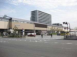 West side of the station, April 2016 | |
| Location |
Nishikyō, Kyoto, Kyoto Japan |
| Operated by | Hankyu Corporation |
| Line(s) | Hankyu Kyoto Main Line |
| Connections |
|
| Other information | |
| Station code | HK-80 |
| History | |
| Opened | 2003 |
| Traffic | |
| Passengers (FY2015[1]) | 4.5 million |
| Location | |
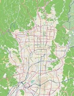 Rakusaiguchi Station Location within Kyoto city  Rakusaiguchi Station Rakusaiguchi Station (Japan) | |
Rakusaiguchi Station (洛西口駅 Rakusaiguchi-eki) is a train station on the Hankyu Kyoto Line. It was opened on March 16, 2003, and serves the communities nestled between Katsura and Muko.
Layout
The elevated station has two side platforms serving two tracks. Both platforms are connected by stairs, elevators and escalators with the ground level where a ticket gate is located.[2]
History
The station opened on March 16, 2003. Until the work to elevate the tracks was completed on March 5, 2016, each platform had its own ticket gate.[3] From October 26, 2013 to March 4, 2016, only Kawaramachi-bound platform was on the elevated track.[4]
Usage
In fiscal 2015 (April 2015 to March 2016), about 4,525,000 passengers used this station annually. For historical data, see the table below.[5][1]
| Year | Number (in thousands) | |
|---|---|---|
| Boarding | Total | |
| 2002 | 53 | |
| 2003 | 614 | |
| 2004 | 602 | |
| 2005 | 1,302 | |
| 2006 | 1,314 | |
| 2007 | 1,405 | 2,635 |
| 2008 | 1,503 | 2,855 |
| 2009 | 1,389 | 2,747 |
| 2010 | 1,419 | 2,749 |
| 2011 | 1,396 | 2,726 |
| 2012 | 1,438 | 2,798 |
| 2013 | 1,425 | 2,756 |
| 2015 | 2,276 | 4,525 |
Stations next to Rakusaiguchi
| « | Service | » | ||
|---|---|---|---|---|
| Hankyu Kyoto Line | ||||
| Commutation Limited Express: Does not stop at this station | ||||
| Limited Express: Does not stop at this station | ||||
| Rapid Express: Does not stop at this station | ||||
| Rapid: Does not stop at this station | ||||
| Higashi-Mukō | Semi-Express | Katsura | ||
| Higashi-Mukō | Local | Katsura | ||
References
- 1 2 第8章 都市施設 [Chapter 8: Urban facilities]. 京都市統計書 [Statistics of Kyoto City] (in Japanese). City of Kyoto. 2017.
- ↑ Hankyu Corporation. 洛西口 (PDF) (in Japanese). Retrieved March 6, 2016.
- ↑ Hankyu Corporation. 洛西口 (PDF) (in Japanese). Retrieved October 26, 2013.
- ↑ City of Kyoto. 阪急京都線(洛西口駅付近)連続立体交差化事業 (in Japanese). Retrieved October 26, 2013.
- ↑ Statistics of Kyoto Prefecture
External links
- Rakusaiguchi Station from Hankyu Railway website (in Japanese)
| Wikimedia Commons has media related to Rakusaiguchi Station. |
Coordinates: 34°57′50.71″N 135°42′11.13″E / 34.9640861°N 135.7030917°E