Raja Ampat Regency
| Raja Ampat Regency Kabupaten Raja Ampat | ||
|---|---|---|
| Regency | ||
 Sunset in Raja Ampat | ||
| ||
 Raja Ampat Islands | ||
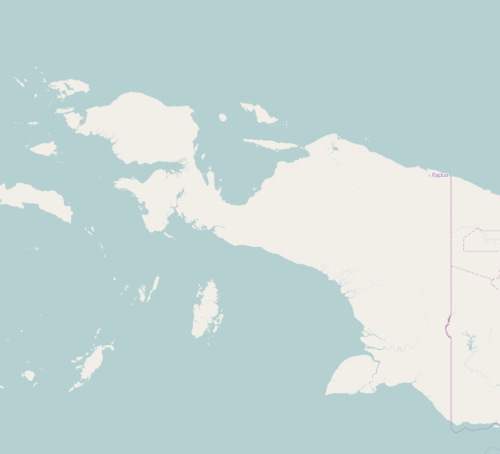 Raja Ampat Regency Location in Western New Guinea and Indonesia  Raja Ampat Regency Raja Ampat Regency (Indonesia) | ||
| Coordinates: 0°50′S 130°30′E / 0.833°S 130.500°ECoordinates: 0°50′S 130°30′E / 0.833°S 130.500°E | ||
| Country | Indonesia | |
| Province | West Papua | |
| Capital | Waisai | |
| Government | ||
| • Regent | Abdul Faris Umlati | |
| • Vice Regent | Manuel Piter Urbinas | |
| Area | ||
| • Total | 8,034.44 km2 (3,102.11 sq mi) | |
| Population (2014) | ||
| • Total | 49,048 | |
| • Density | 6.1/km2 (16/sq mi) | |
| Time zone | UTC+9 (Indonesia Eastern Time) | |
| Area code | (+62) 956 | |
| Website | rajaampatkab | |
Raja Ampat Regency is a regency of West Papua province of Indonesia. The regency, which was formed based on the Law 26 of 2002, was inaugurated on 12 April 2003, and consists of a number of groups of islands situated off the north-west end of West Papua; the four main islands are Misool, Salawati, Batanta, and Waigeo. At present, the regency covers a land area of 8,034.44 km2, and had a population of 42,507 at the 2010 Census; the latest official estimate (as at January 2014) is 49,048. The principal town lies at Waisai.
On 25 October 2013 the Indonesian House of Representatives (DPR) began reviewing draft laws on the establishment of new regencies, including two new regencies of North Raja Ampat and South Raja Ampat within the borders of the existing Raja Ampat Regency.
Administrative Districts
The existing regency comprises seventeen districts (kecamatan), tabulated below with their populations at the 2010 Census:[1]
|
|
|
Misool and Kofiau Islands (comprising the first six districts listed above) are currently in the process of being split off to form a separate South Raja Ampat Regency under proposals approved in 2014 by the Indonesian Government.
Transport
Air
In early May 2012, a 1,200 meters runway of Marinda Airport has been officially opened by Transportation minister and Raja Ampat official. The runway will be extended to 2,000 meters and was predicted to be finished in 2013.[2]
References
- ↑ Biro Pusat Statistik, Jakarta, 2011.
- ↑ "Pengembangan Infrastruktur Bandara Raja Ampat Hingga 2013". May 26, 2012. Archived from the original on October 14, 2014.
| Wikimedia Commons has media related to Raja Ampat. |
Regencies and cities of West Papua | ||
|---|---|---|
Capital: Manokwari | ||
| Regencies | ||
| Cities | ||