Radda in Chianti
| Radda in Chianti | ||
|---|---|---|
| Comune | ||
| Comune di Radda in Chianti | ||
.jpg) | ||
| ||
 Radda in Chianti Location of Radda in Chianti in Italy | ||
| Coordinates: 43°29′N 11°23′E / 43.483°N 11.383°E | ||
| Country | Italy | |
| Region | Tuscany | |
| Province | Siena (SI) | |
| Frazioni | Badia a Montemuro, Colle Petroso, La Villa, Lucarelli, Monterinaldi, Palagio, Selvole, Volpaia | |
| Government | ||
| • Mayor | Pier Paolo Mugnaini | |
| Area | ||
| • Total | 80.42 km2 (31.05 sq mi) | |
| Time zone | UTC+1 (CET) | |
| • Summer (DST) | UTC+2 (CEST) | |
Coordinates: 43°29′11″N 11°18′10″E / 43.4864262°N 11.3027097°E
| population_total = 1587 | population_as_of = 31 December 2016 | pop_density_footnotes = | population_demonym = Raddesi | elevation_footnotes = | elevation_m = 530 | twin1 = | twin1_country = | saint = | day = | postal_code = 53017 | area_code = 0577 | website = Official website | footnotes =
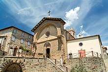
Radda in Chianti is a comune (municipality) in the Province of Siena in the Italian region Tuscany, located about 35 kilometres (22 miles) southeast of Florence and about 15 km (9 miles) north of Siena.
Radda in Chianti borders the following municipalities: Castellina in Chianti, Castelnuovo Berardenga, Cavriglia, Gaiole in Chianti, Greve in Chianti.
Twin towns

See also
References
External links
| Wikimedia Commons has media related to Radda in Chianti. |