Raach am Hochgebirge
| Raach am Hochgebirge | ||
|---|---|---|
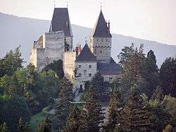 Wartenstein castle | ||
| ||
 Raach am Hochgebirge Location within Austria | ||
| Coordinates: 47°38′N 15°56′E / 47.633°N 15.933°ECoordinates: 47°38′N 15°56′E / 47.633°N 15.933°E | ||
| Country | Austria | |
| State | Lower Austria | |
| District | Neunkirchen | |
| Government | ||
| • Mayor | Rupert Dominik | |
| Area | ||
| • Total | 13.25 km2 (5.12 sq mi) | |
| Elevation | 813 m (2,667 ft) | |
| Population (1 January 2016)[1] | ||
| • Total | 291 | |
| • Density | 22/km2 (57/sq mi) | |
| Time zone | UTC+1 (CET) | |
| • Summer (DST) | UTC+2 (CEST) | |
| Postal code | 2640 | |
| Area code | 02662 | |
| Website | www.raach.at | |

Raach am Hochgebirge is a town in the district of Neunkirchen in the Austrian state of Lower Austria.
Population
| Historical population | ||
|---|---|---|
| Year | Pop. | ±% |
| 1869 | 467 | — |
| 1880 | 480 | +2.8% |
| 1890 | 426 | −11.3% |
| 1900 | 483 | +13.4% |
| 1910 | 506 | +4.8% |
| 1923 | 477 | −5.7% |
| 1934 | 481 | +0.8% |
| 1939 | 481 | +0.0% |
| 1951 | 457 | −5.0% |
| 1961 | 444 | −2.8% |
| 1971 | 361 | −18.7% |
| 1981 | 325 | −10.0% |
| 1991 | 323 | −0.6% |
| 2001 | 304 | −5.9% |
| 2011 | 277 | −8.9% |
References
- ↑ Statistik Austria - Bevölkerung zu Jahresbeginn 2002-2016 nach Gemeinden (Gebietsstand 1.1.2016) for Raach am Hochgebirge.
This article is issued from
Wikipedia.
The text is licensed under Creative Commons - Attribution - Sharealike.
Additional terms may apply for the media files.