Queenscliff, New South Wales
| Queenscliff Sydney, New South Wales | |||||||||||||||
|---|---|---|---|---|---|---|---|---|---|---|---|---|---|---|---|
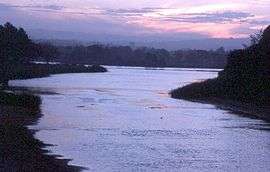 Manly Lagoon, dusk | |||||||||||||||
| Population | 3,376 (2016 census)[1] | ||||||||||||||
| Postcode(s) | 2096 | ||||||||||||||
| Location | 16 km (10 mi) north-east of Sydney CBD | ||||||||||||||
| LGA(s) | Northern Beaches Council | ||||||||||||||
| State electorate(s) | Manly | ||||||||||||||
| Federal Division(s) | Warringah | ||||||||||||||
| |||||||||||||||
Queenscliff is a suburb of northern Sydney, in the state of New South Wales, Australia. Queenscliff is located 16 kilometres north-east of the Sydney central business district, in the local government area of Northern Beaches Council and is part of the Northern Beaches region.
History
Queenscliff was named in honour of Queen Victoria. The area was popular with holiday-makers from the early 1900s to World War I, who stayed in holiday shacks on the headland.[2]
Queenscliff is famous amongst the Australian surf beaches for its "heavy" waves (bomboras) that break out at sea. The stories recounting how Dave Jackman dared to ride one in 1961 gave rise to big wave surfing in Australia.[3]
Population
In the 2016 Census, there were 3,376 people in Queenscliff. 57.0% of people were born in Australia. The most common countries of birth were England 9.5% and New Zealand 4.0%. 79.7% of people only spoke English at home. The most common responses for religion were No Religion 43.8%, Catholic 22.6%, and Anglican 13.0%.[1]
Geography
Queenscliff Beach is situated at the northern end of a long stretch of beach at Manly that includes North Steyne Beach and Manly Beach.
Manly Lagoon was originally called Curl Curl Lagoon[4] and the name Curl Curl appears to be the original Aboriginal name for the Queenscliff, Manly Vale area, Manly Creek was originally Curl Curl Creek and Queenscliff Headland was originally Curl Curl Headland.
References
- 1 2 Australian Bureau of Statistics (27 June 2017). "Queenscliff (State Suburb)". 2016 Census QuickStats. Retrieved 19 November 2017.

- ↑ The Book of Sydney Suburbs, Compiled by Frances Pollon, Angus & Robertson Publishers, 1990, Published in Australia ISBN 0-207-14495-8, page 216
- ↑ "Episode 1". Bombora: The Story of Australian Surfing. Season 1. Episode 2. 2009-03-26.
- ↑ http://www.manly.nsw.gov.au/IgnitionSuite/uploads/docs/Curl%20Curl%20Lagoon%20-%20early%20history.pdf Manly Council
External links
| Wikimedia Commons has media related to Queenscliff. |
- "Gosford Lagoons & Sydney Northern Beaches" (map). Office of Environment and Heritage. Government of New South Wales.
Coordinates: 33°46′57″S 151°17′05″E / 33.78250°S 151.28472°E