Punta Negra District
| Punta Negra District Distrito de Punta Negra | ||
|---|---|---|
| District | ||
 La Bikini beach, view from El Chanque. | ||
| ||
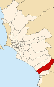 Location of Punta Negra in the Lima province | ||
| Country |
| |
| Region | Lima | |
| Province | Lima | |
| Founded | April 7, 1954 | |
| Government | ||
| • Mayor | Willington Robespierre Ojeda Guerra [1] | |
| Area | ||
| • Total | 130.5 km2 (50.4 sq mi) | |
| Population (estimate) | ||
| • Total | 4,000 | |
| • Density | 31/km2 (79/sq mi) | |
| Time zone | UTC-5 (PET) | |
| UBIGEO | 150127 | |
| Website | munipuntanegra.gob.pe | |

The Peruvian district of Punta Negra is one of the 43 districts of the Province of Lima. It borders the district of Punta Hermosa to the north, the Province of Huarochirí to the east, the district of San Bartolo to the south, and the Pacific Ocean to the west.
History
In precolombian times, the area of the current district was inhabited by coastal fishermen of the Yungas people, and was under the hegemony of the rulers of Pachacamac, and later the Incas. Post-conquest, the area was known as Tropezon, until passage of the Law Nº 12096 created the modern district of Punta Negra on April 7, 1954. Its name is attributed to an Italo-Peruvian citizen named Lidio Mongilardi, who upon visiting the area for the first time reportedly compared it to a coastal zone in Italy known as Punta Negra. As a popular beach destination, various Peruvian social clubs have beach venues in this district, the most notable being the Country Club El Bosque and the Club Social y Deportes Punta Negra.
Geography
The district has an area of 130.5 km2, most of which is uninhabited desert. It is estimated to have more than 8,000 permanent residents, and 11,000 during the summer beach season. The district has several beaches, including Cangrejos, Punta Rocas, El Puerto, La Pocita, La Bikini, El Revés, Santa Rosa and Peñascal. A highlight is the Quebrada de Cruz de Hueso, whose mouth can be found on Peñascal beach.
Government
The municipal council is responsible for taxes and regulations, and includes a mayor and local councilors
Local Politicians
Mayors of Punta Negra
- 2011-2014[2]
- Mayor: Francisco Buitrón Huapaya, Willington Robespierre Ojeda Guerra, Siempre Unidos Party (SU).
- Local Councillors:
Religious Organization
- Parish
- Parish Priest: Padre Félix.
Festividades
- Club Punta Negra:
- January: New Year's Celebration
- February: Kermesse, Luau Party
- March: Carnival
- December: Start of Season Lunch
- March: Feast of Saint Joseph
- June: Feast of Saint Peter.
Urban Landmarks
Several Peruvian country clubs have their main location in this district, including Country Club El Bosque Club Social y Deportes Punta Negra.
See also
References
External links
| Wikimedia Commons has media related to Punta Negra District. |
Coordinates: 12°22′05″S 76°47′50″W / 12.36806°S 76.79722°W