Pullampeta
| Pullampeta | |
|---|---|
| Village | |
 Pullampeta Location in Andhra Pradesh, India  Pullampeta Pullampeta (India) | |
| Coordinates: 14°07′00″N 79°13′00″E / 14.1167°N 79.2167°ECoordinates: 14°07′00″N 79°13′00″E / 14.1167°N 79.2167°E | |
| Country | India |
| State | Andhra Pradesh |
| District | Kadapa |
| Talukas | Pullampet |
| Languages | |
| • Official | Telugu |
| Time zone | UTC+5:30 (IST) |
| PIN | 516107 |
| Vehicle registration | AP |
Pullampet is a village in Kadapa district of the Indian state of Andhra Pradesh. It is located in Pullampeta mandal of Rajampeta revenue division.[1]
Geography
Pullampet is located at 14°07′00″N 79°13′00″E / 14.1167°N 79.2167°E. It has an average elevation of 161 meters (531 feet).
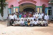
SBVDSHSchool
References
- ↑ "Revenue Divisions and Mandals". Official website of YSR Kadapa District. National Informatics Centre- Kadapa, Andhra Pradesh. Retrieved 23 May 2015.
This article is issued from
Wikipedia.
The text is licensed under Creative Commons - Attribution - Sharealike.
Additional terms may apply for the media files.