Pugieu
| Pugieu | |
|---|---|
 | |
 Pugieu Location within Auvergne-Rhône-Alpes region  Pugieu | |
| Coordinates: 45°49′00″N 5°39′00″E / 45.8167°N 5.65°ECoordinates: 45°49′00″N 5°39′00″E / 45.8167°N 5.65°E | |
| Country | France |
| Region | Auvergne-Rhône-Alpes |
| Department | Ain |
| Arrondissement | Belley |
| Canton | Belley |
| Area1 | 4.85 km2 (1.87 sq mi) |
| Population (2008)2 | 146 |
| • Density | 30/km2 (78/sq mi) |
| Time zone | UTC+1 (CET) |
| • Summer (DST) | UTC+2 (CEST) |
| INSEE/Postal code | 01316 /01510 |
| Elevation |
238–409 m (781–1,342 ft) (avg. 245 m or 804 ft) |
|
1 French Land Register data, which excludes lakes, ponds, glaciers > 1 km2 (0.386 sq mi or 247 acres) and river estuaries. 2 Population without double counting: residents of multiple communes (e.g., students and military personnel) only counted once. | |
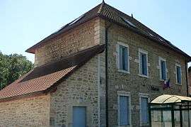
Pugieu is a former commune in the Ain department in eastern France. On 1 January 2017, it was merged into the commune Chazey-Bons.[1]
Population
| Historical population | ||
|---|---|---|
| Year | Pop. | ±% |
| 1793 | 276 | — |
| 1800 | 262 | −5.1% |
| 1806 | 311 | +18.7% |
| 1821 | 223 | −28.3% |
| 1831 | 317 | +42.2% |
| 1836 | 302 | −4.7% |
| 1841 | 300 | −0.7% |
| 1846 | 308 | +2.7% |
| 1851 | 601 | +95.1% |
| 1856 | 343 | −42.9% |
| 1861 | 343 | +0.0% |
| 1866 | 336 | −2.0% |
| 1872 | 359 | +6.8% |
| 1876 | 365 | +1.7% |
| 1881 | 350 | −4.1% |
| 1886 | 250 | −28.6% |
| 1891 | 256 | +2.4% |
| 1896 | 256 | +0.0% |
| 1901 | 242 | −5.5% |
| 1906 | 234 | −3.3% |
| 1911 | 197 | −15.8% |
| 1921 | 152 | −22.8% |
| 1926 | 155 | +2.0% |
| 1931 | 160 | +3.2% |
| 1936 | 147 | −8.1% |
| 1946 | 138 | −6.1% |
| 1954 | 116 | −15.9% |
| 1962 | 123 | +6.0% |
| 1968 | 109 | −11.4% |
| 1975 | 91 | −16.5% |
| 1982 | 108 | +18.7% |
| 1990 | 123 | +13.9% |
| 1999 | 126 | +2.4% |
| 2008 | 146 | +15.9% |
See also
References
- ↑ Arrêté préfectoral 30 June 2016 (in French)
| Wikimedia Commons has media related to Pugieu. |
This article is issued from
Wikipedia.
The text is licensed under Creative Commons - Attribution - Sharealike.
Additional terms may apply for the media files.