Puerto Rico Highway 14
| ||||
|---|---|---|---|---|
 | ||||
| Route information | ||||
| Maintained by DTOP | ||||
| Existed | 1886 (as the old Carretera Central) – present | |||
| Major junctions | ||||
| North end |
| |||
| ||||
| South end |
| |||
| Highway system | ||||
| ||||


Puerto Rico Highway 14 is a main highway connecting Cayey, Puerto Rico to Ponce, Puerto Rico. The road runs the same course as the historic Carretera Central. The Coamo-to-Ponce section of PR-14 was built under the direction of Spanish engineer Raimundo Camprubí Escudero (b. Pamplona 15 March 1846 - d. Madrid 1924).[1]
Road description
.svg.png)
Detailed map of PR-14 in the Municipality of Ponce
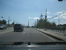
%2C_Barrio_Machuelo_Abajo%2C_Ponce%2C_PR.jpg)
Except in the city of Ponce where, with the exception of the Ponce Historic Zone, the road is a 4-lane road, the rest of PR-14 is a two-lane country road as it makes its way through the four towns it runs through, Juana Diaz, Coamo, Aibonito and Cayey. PR-14 is one of the roads that lead into the Ponce Historic Zone.[2]
Major intersections
- Puerto Rico Highway 1
- Puerto Rico Highway 206
- Puerto Rico Highway 721
- Puerto Rico Highway 138
- Puerto Rico Highway 149
- Puerto Rico Highway 506
- Puerto Rico Highway 10
- Puerto Rico Highway 139
- Puerto Rico Highway 505
- Puerto Rico Highway 12
- Puerto Rico Highway 1
See also
References
- ↑ Ingenieros de Caminos en Puerto Rico: 1866-1898. Fernando Sáenz Ridruejo. "Anuario de Estudios Atlanticos." ISSN 0570-4065. Las Palmas de Gran Canaria (2009). No 55. p.334.
- ↑ Ponce. Let's Go. Archived 2010-12-04 at the Wayback Machine.
External links
- Carretera Militar/Military Road Porto Rico. Overland Monthly and Out West Magazine. Page 321. Retrieved 27 July 2013.
This article is issued from
Wikipedia.
The text is licensed under Creative Commons - Attribution - Sharealike.
Additional terms may apply for the media files.