Przhevalskoye
| Przhevalskoye Пржевальское (Russian) | |
|---|---|
|
- Urban-type settlement[1] - Settlement[1] | |
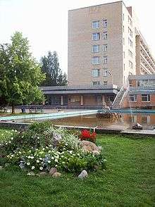
 Administration building in Przhevalskoye | |
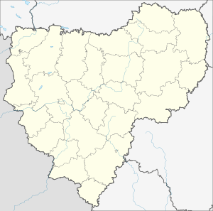
.svg.png) Location of Smolensk Oblast in Russia | |
 Przhevalskoye | |
| Administrative status (as of June 2014) | |
| Country | Russia |
| Federal subject | Smolensk Oblast[1] |
| Administrative district | Demidovsky District[1] |
| Urban settlement | Przhevalskoye[1] |
| Administrative center of | Przhevalskoye Urban Settlement[1] |
| Municipal status (as of May 2015) | |
| Municipal district | Demidovsky Municipal District[2] |
| Urban settlement | Przhevalskoye Urban Settlement[2] |
| Administrative center of | Przhevalskoye Urban Settlement[3] |
| Statistics | |
| Area (urban settlement) (February 2014) | 11.25 km2 (4.34 sq mi)[1] |
| Population (2010 Census) | 1,683 inhabitants[4] |
| Density | 150/km2 (390/sq mi)[5] |
| Time zone | MSK (UTC+03:00)[6] |
| Urban-type settlement status since | 1974 |
| Previous names | Sloboda (until 1964)[7] |
| Postal code(s)[8] | 216270 |
| Przhevalskoye on Wikimedia Commons | |
| 2010 Census | 1,683[4] |
|---|---|
| 2002 Census | 2,110[9] |
| 1989 Census | 2,883[10] |
| 1979 Census | 2,811[11] |
Przhevalskoye (Russian: Пржева́льское) is an urban locality (a settlement) in Demidovsky District of Smolensk Oblast, Russia, located in the northwestern part of the oblast, on Lake Sapsho, northeast of the town of Demidov, the administrative center of the district. It is a terminus of the Demidov-Przhevalskoye Highway. As of the 2010 Census, its population was 1,683.[4]
The settlement is home to the Museum of Nikolay Przhevalsky, which occupies the mansion of the famous traveler. Previously called Sloboda (Слобода́),[7] it was renamed after Przhevalsky in 1964.[12]
History
The village of Sloboda was first mentioned in 1724 in connection with the building of the church,[13] although the place had been inhabited long before that. Archeologists found ceramic products of the 4th or 3rd millennium BCE.[14] In the 4th-8th centuries, it was inhabited by the Krivichs.[14] People also lived in these lands at later times. Along the rivers and lakes (including Lake Sapsho), there was the trade route from the Varangians to the Greeks, and not so far away there was the second big city of the Principality of Smolensk called Verzhavsk (Вержавск).[15][16] In the 19th century, it was an outlying area with little economic activity.[17] It was the reason why Nikolay Przhevalsky bought an estate here in 1881. In the middle of the 20th century, Przhevalskoye-Sloboda became famous during World War II for its partisan defenders.[18] From September 1942 to September 1943, the front line ran through the village.[19] Almost all buildings were burnt. The partisans' staff was located in the partly ruined church.
In the 19th century, Sloboda belonged to Porechsky Uyezd of Smolensk Governorate. In 1927, it was transferred to Yartsevsky Uyezd of the same governorate.[20] On 12 July 1929, governorates and uyezds were abolished, and Slobodskoy District with the administrative center in Sloboda was established. The district belonged to Smolensk Okrug of Western Oblast. In 1930, the district was abolished and split between Demidovsky, Ilyinsky, Prechistensky, and Velizhsky Districts. In 1938, it was re-established. In 1960, Slobodskoy District was abolished and merged into Demidovsky District.[21]
The settlement has been serving as a health resort since mineral waters were discovered in the 1970s, and a sanatorium (the largest in Smolensk Oblast was built in 1974.[22]). Also in 1974, it was granted urban-type settlement status.
Przhevalskoye is also a part of Smolenskoye Poozerye National Park.
Economy
Transportation
A paved road connects Przhevalskoye with Demidov, where it has access to R133 highway to Smolensk, Nevel via Velizh, and a road to Rudnya.
Sights

- Lake Sapsho with its six islands and one "under-water island", as well as tumuli nearby
- Lake Mutnoye (sapropelic mud)
- Museum of Nikolay Przhevalsky; the only such museum in Russia
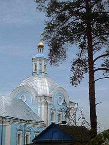
- The church of the Ascension
References
Notes
- 1 2 3 4 5 6 7 Resolution #261
- 1 2 Law #131-z
- ↑ Федеральная служба государственной статистики. Федеральное агентство по технологическому регулированию и метрологии. №ОК 033-2013 1 января 2014 г. «Общероссийский классификатор территорий муниципальных образований. Код 66 611 153». (Federal State Statistics Service. Federal Agency on Technological Regulation and Metrology. #OK 033-2013 January 1, 2014 Russian Classification of Territories of Municipal Formations. Code 66 611 153. ).
- 1 2 3 Russian Federal State Statistics Service (2011). "Всероссийская перепись населения 2010 года. Том 1" [2010 All-Russian Population Census, vol. 1]. Всероссийская перепись населения 2010 года (2010 All-Russia Population Census) (in Russian). Federal State Statistics Service. Retrieved June 29, 2012.
- ↑ The value of density was calculated automatically by dividing the 2010 Census population by the area specified in the infobox. Please note that this value may not be accurate as the area specified in the infobox does not necessarily correspond to the area of the entity proper or is reported for the same year as the population.
- ↑ Правительство Российской Федерации. Федеральный закон №107-ФЗ от 3 июня 2011 г. «Об исчислении времени», в ред. Федерального закона №271-ФЗ от 03 июля 2016 г. «О внесении изменений в Федеральный закон "Об исчислении времени"». Вступил в силу по истечении шестидесяти дней после дня официального опубликования (6 августа 2011 г.). Опубликован: "Российская газета", №120, 6 июня 2011 г. (Government of the Russian Federation. Federal Law #107-FZ of June 31, 2011 On Calculating Time, as amended by the Federal Law #271-FZ of July 03, 2016 On Amending Federal Law "On Calculating Time". Effective as of after sixty days following the day of the official publication.).
- 1 2 Борисенков Ю. Новый рассвет над озером Сапшо // Поречанка. № 25/26, 31 марта 2006. — С. 4-5
- ↑ Почта России. Информационно-вычислительный центр ОАСУ РПО. (Russian Post). Поиск объектов почтовой связи (Postal Objects Search) (in Russian)
- ↑ Russian Federal State Statistics Service (May 21, 2004). "Численность населения России, субъектов Российской Федерации в составе федеральных округов, районов, городских поселений, сельских населённых пунктов – районных центров и сельских населённых пунктов с населением 3 тысячи и более человек" [Population of Russia, Its Federal Districts, Federal Subjects, Districts, Urban Localities, Rural Localities—Administrative Centers, and Rural Localities with Population of Over 3,000] (XLS). Всероссийская перепись населения 2002 года [All-Russia Population Census of 2002] (in Russian). Retrieved August 9, 2014.
- ↑ Demoscope Weekly (1989). "Всесоюзная перепись населения 1989 г. Численность наличного населения союзных и автономных республик, автономных областей и округов, краёв, областей, районов, городских поселений и сёл-райцентров" [All Union Population Census of 1989: Present Population of Union and Autonomous Republics, Autonomous Oblasts and Okrugs, Krais, Oblasts, Districts, Urban Settlements, and Villages Serving as District Administrative Centers]. Всесоюзная перепись населения 1989 года [All-Union Population Census of 1989] (in Russian). Институт демографии Национального исследовательского университета: Высшая школа экономики [Institute of Demography at the National Research University: Higher School of Economics]. Retrieved August 9, 2014.
- ↑ "Всесоюзная перепись населения 1979 г. Национальный состав населения по регионам России. (All Union Population Census of 1979. Ethnic composition of the population by regions of Russia.)". Всесоюзная перепись населения 1979 года (All-Union Population Census of 1979) (in Russian). Demoscope Weekly (website of the Institute of Demographics of the State University—Higher School of Economics. 1979. Retrieved 2008-11-25.
- ↑ Культурное наследие земли Смоленской. «Здесь будет моё гнездо» Е. Гавриленкова Archived July 21, 2011, at the Wayback Machine.
- ↑ Епархиальные ведомости, 1901, № 11
- 1 2 Шмидт Е. А. Древнерусские археологические памятники Смоленской области. — Ч. I. — М., 1982. — С. 53
- ↑ Городище (Вержавск)
- ↑ Седов В. В. К исторической географии Смоленской земли // Материалы по изучению Смоленской области: в 4. — Смоленск, 1961. — С.317-326
- ↑ Межевая книга сельца Слободы, сочинённая 1849 года июня 18 дня уездным поречским землемером Подъельским
- ↑ В. Гавриленков. Мы — горьковские! // Путь Ильича. № 31 (1087), 14 марта 1970. — С. 2
- ↑ К. Немцев. Бои местного значения // Путь Ильича. № 132, 14 ноября 1971. — С. 7
- ↑ "Пржевальское городское поселение" (in Russian). Przhevalskoye Urban Settlement. Retrieved 15 September 2016.
- ↑ Борис Парфенов; Ольга Хоренженкова. "К истории формирования Смоленской области" (in Russian). Смоленск. Retrieved 18 June 2016.
- ↑ Санаторий имени Н. М. Пржевальского
Sources
- Администрация Смоленской области. Постановление №261 от 30 апреля 2008 г. «Об утверждении реестра административно-территориальных единиц и территориальных единиц Смоленской области», в ред. Постановления №464 от 27 июня 2014 г. «О внесении изменений в реестр административно-территориальных единиц и территориальных единиц Смоленской области». Опубликован: База данных "Консультант-плюс". (Administration of Smolensk Oblast. Resolution #261 of April 30, 2008 On the Adoption of the Registry of the Administrative-Territorial Units and Territorial Units of Smolensk Oblast, as amended by the Resolution #464 of June 27, 2014 On Amending the Registry of the Administrative-Territorial Units and Territorial Units of Smolensk Oblast. ).
- Смоленская областная Дума. Закон №131-з от 28 декабря 2004 г. «О наделении статусом муниципального района муниципального образования "Демидовский район" Смоленской области, об установлении границ муниципальных образований, территории которых входят в его состав, и наделении их соответствующим статусом», в ред. Закона №74-з от 28 мая 2015 г. «О внесении изменений в областной Закон "О наделении статусом муниципального района муниципального образования "Демидовский район" Смоленской области, об установлении границ муниципальных образований, территории которых входят в его состав, и наделении их соответствующим статусом"». Вступил в силу со дня официального опубликования. Опубликован: "Вестник Смоленской областной Думы и Администрации Смоленской области", №14, часть II, стр. 6, 30 декабря 2004 г. (Smolensk Oblast Duma. Law #131-z of December 28, 2004 On Granting the Status of the Municipal District to the Municipal Formation of "Demidovsky District" of Smolensk Oblast, on Establishing the Borders of the Municipal Formations the Territories of Which It Comprises, and on Granting Them Appropriate Status, as amended by the Law #74-z of May 28, 2015 On Amending the Oblast Law "On Granting the Status of the Municipal District to the Municipal Formation of "Demidovsky District" of Smolensk Oblast, on Establishing the Borders of the Municipal Formations the Territories of Which It Comprises, and on Granting Them Appropriate Status". Effective as of the official publication date.).
| Districts | |||
|---|---|---|---|
| Cities and towns | |||
| Urban-type settlements |
| ||