Princeton Aerodrome
| Princeton Aerodrome | |||||||||||
|---|---|---|---|---|---|---|---|---|---|---|---|
 | |||||||||||
| Summary | |||||||||||
| Airport type | Public | ||||||||||
| Owner/Operator | Town of Princeton | ||||||||||
| Location | Princeton, British Columbia | ||||||||||
| Time zone | PST (UTC−08:00) | ||||||||||
| • Summer (DST) | PDT (UTC−07:00) | ||||||||||
| Elevation AMSL | 2,302 ft / 702 m | ||||||||||
| Coordinates | 49°28′04″N 120°30′45″W / 49.46778°N 120.51250°WCoordinates: 49°28′04″N 120°30′45″W / 49.46778°N 120.51250°W | ||||||||||
| Map | |||||||||||
 CYDC Location in British Columbia | |||||||||||
| Runways | |||||||||||
| |||||||||||
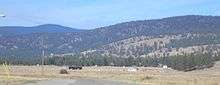
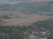
Princeton Aerodrome, (ICAO: CYDC), is located adjacent to Princeton, British Columbia, Canada.
History
The airport was originally intended as an alternate landing area for early commercial aviation. The main (highest traffic) use of the airport was as the home of the Royal Canadian Air Cadet Regional Gliding School whose traffic peaked annually each July and August. The Gliding School moved to Chilliwack Airport after the 1991 season and then to Canadian Forces Base Comox.
The airport has undergone some improvements since the early 1990s. Fuel is now available; both Jet A (22,000 litres) and 100LL (13,000 litres). All major credit cards are accepted through a self serve system. For larger turbine aircraft there is a certified fuel truck that holds 7,000 litres of Jet A and can be brought to the waiting aircraft.
References
- ↑ Canada Flight Supplement. Effective 0901Z 19 July 2018 to 0901Z 13 September 2018.
- ↑ Synoptic/Metstat Station Information
External links
- Princeton Airport on COPA's Places to Fly airport directory
- Past three hours METARs, SPECI and current TAFs for Princeton Airport from Nav Canada as available.
| By name | |
|---|---|
| By location indicator | |
| By province/territory | |
| By area | |
| National Airports System | |
| Related | |
| |