Prieto Diaz, Sorsogon
| Prieto Diaz | |
|---|---|
| Municipality | |
| Municipality of Prieto Diaz | |
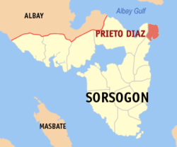 Map of Sorsogon with Prieto Diaz highlighted | |
.svg.png) Prieto Diaz Location within the Philippines | |
| Coordinates: 13°02′N 124°11′E / 13.03°N 124.18°ECoordinates: 13°02′N 124°11′E / 13.03°N 124.18°E | |
| Country |
|
| Region | Bicol Region (Region V) |
| Province | Sorsogon |
| District | 2nd district of Sorsogon |
| Barangays | 23 (see Barangays) |
| Government [1] | |
| • Type | Sangguniang Bayan |
| • Mayor | Benito L. Doma |
| • Electorate | 12,227 voters (2016) |
| Area [2] | |
| • Total | 49.07 km2 (18.95 sq mi) |
| Population (2015 census)[3] | |
| • Total | 22,442 |
| • Density | 460/km2 (1,200/sq mi) |
| Time zone | UTC+8 (PST) |
| ZIP code | 4711 |
| PSGC | 056214000 |
| IDD : area code | +63 (0)56 |
| Climate type | Tropical rainforest climate |
| Income class | 5th municipal income class |
| Revenue (₱) | 61,385,927.49 (2016) |
| Native languages |
Central Bikol Sorsoganon language Tagalog |
Prieto Diaz, officially the Municipality of Prieto Diaz, is a 5th class municipality in the province of Sorsogon, Philippines. According to the 2015 census, it has a population of 22,442 people.[3]
History
The town of Prieto Diaz was once a Visita of the old Municipality of Bacon (now Bacon District of Sorsogon City). The town was given its present name of the two Bicolano martyrs, Father Gabriel Prieto (1853–1897) and Father Severino Diaz (1862–1897) when it became independent from the Municipality of Bacon on October 12, 1903 by virtue of Act 940 of the Philippine Commission. Prieto Diaz was the only town organized after Sorsogon became a Province on October 17, 1894.[4]
Geography
Prieto Diaz is 387 km (241 mi) southeast of Manila, 150 km(31m) east-southeast of Legazpi City the regional center and 20 km (12.4 mi) north-north-east of Sorsogon City the provincial capital. North of Prieto Diaz across the Albay Gulf is Rapu-Rapu, Albay, on the west is Bacon District of Sorsogon City and on the south is Gubat, Sorsogon while Pacific Ocean is on the east. It is also the easternmost point on the Island of Luzon.
Sorsogon Ayta Language
In 2010, UNESCO released its 3rd world volume of Endangered Languages in the World, where 3 critically endangered languages were in the Philippines. One of these languages in the Southern Ayta (Sorsogon Ayta) language which has an estimated speaker of 150 people in the year 2000. The language was classified as Critically Endangered, meaning the youngest speakers are grandparents and older, and they speak the language partially and infrequently and hardly pass the language to their children and grandchildren anymore. If the remaining 150 people do not pass their native language to the next generation of Sorsogon Ayta people, their indigenous language will be extinct within a period of 1 to 2 decades.
The Sorsogon Ayta people live only on the municipality of Prieto Diaz, Sorsogon. They are one of the original Negrito settlers in the entire Philippines. They belong to the Aeta people classification, but have distinct language and belief systems unique to their own culture and heritage.
Climate
Prieto Diaz has a tropical climate. There is significant rainfall throughout the year in Prieto Diaz. Even the driest month still has a lot of rainfall. According to Köppen and Geiger climate is classified as Af. The average annual temperature in Prieto Diaz is 27.1 °C. The average annual rainfall is 2965 mm. The driest month is April with 119 mm. Most precipitation falls in December, with an average of 514 mm. The warmest month of the year is June with an average temperature of 28.2 °C. In January, the average temperature is 25.6 °C. It is the lowest average temperature of the whole year.The difference in precipitation between the driest month and the wettest month is 395 mm. The average temperatures vary during the year by 2.6 °C.[5]
Typhoons are an especially frequent and destructive menace in the Bicol region. The months of September, October and November experience the more destructive of these violent tropical storms. Forty percent of the storms carrying high-velocity winds in the Philippine pass through Southeastern Luzon where Prieto Diaz is located.[6]
| Climate data for Prieto Diaz | |||||||||||||
|---|---|---|---|---|---|---|---|---|---|---|---|---|---|
| Month | Jan | Feb | Mar | Apr | May | Jun | Jul | Aug | Sep | Oct | Nov | Dec | Year |
| Average high °C (°F) | 29.0 (84.2) |
29.4 (84.9) |
30.3 (86.5) |
31.4 (88.5) |
32.3 (90.1) |
32.4 (90.3) |
32.0 (89.6) |
32.1 (89.8) |
32.0 (89.6) |
31.2 (88.2) |
30.4 (86.7) |
29.5 (85.1) |
31 (87.8) |
| Average low °C (°F) | 22.3 (72.1) |
22.2 (72) |
22.6 (72.7) |
23.3 (73.9) |
24.0 (75.2) |
24.1 (75.4) |
23.9 (75) |
24.1 (75.4) |
23.8 (74.8) |
23.4 (74.1) |
23.3 (73.9) |
23.1 (73.6) |
23.3 (74) |
| Average rainfall mm (inches) | 349 (13.74) |
238 (9.37) |
186 (7.32) |
119 (4.69) |
123 (4.84) |
146 (5.75) |
179 (7.05) |
132 (5.2) |
200 (7.87) |
331 (13.03) |
448 (17.64) |
514 (20.24) |
2,965 (116.74) |
| Source: [5] | |||||||||||||
Local Government
The following are the elected officials of Prieto Diaz, Sorsogon for the term 2013-2016[7]
| Mayor | Benito Doma (LP) |
|---|---|
| Vice Mayor | Edwin Destajo (LP) |
| Councilors |
Political Subdivision
Prieto Diaz is politically subdivided into 23 barangays. In 1954, sitio Carayat was converted into a barrio.[8]
| Barangays | Class | Population[9] | Barangay head |
|---|---|---|---|
| Brillante (Poblacion) | Rural | 624 | Florante D. Detecio |
| Bulawan | Rural | 827 | Manuel S. Barcela, Sr. |
| Calao | Rural | 1,786 | Rey E. Llona |
| Carayat | Rural | 810 | Melvin E. Demdam |
| Diamante | Rural | 1,581 | Edwin D. Emaas |
| Gogon | Rural | 1,585 | Anilo Domalaon |
| Lupi | Rural | 726 | Alexander D. Detablan |
| Maningcay De Oro | Urban | 1,234 | Glenda D. Eva |
| Manlabong | Rural | 793 | Bienvenido D. Ayo |
| Perlas | Rural | 405 | Criselda A. Domanais |
| Quidolog | Rural | 842 | Pablo D. Destura |
| Rizal | Rural | 863 | Elvira E. Oandasan |
| San Antonio | Rural | 481 | Melchor D. Bayoca |
| San Fernando | Rural | 1,482 | Luis Lee E. Espena, Jr. |
| San Isidro | Rural | 1,212 | Joseph L. Domagtoy |
| San Juan | Rural | 687 | Filander D. Dumasig |
| San Rafael | Rural | 655 | Ruben E. Esplana |
| San Ramon | Rural | 452 | Jose C. Estipona, Jr. |
| Santa Lourdes | Rural | 959 | Mario A. Domdom |
| Santo Domingo | Rural | 285 | Leonardo D. Golena |
| Talisayan | Rural | 781 | Ma. Melissa B. Diolata |
| Tupaz | Rural | 409 | Ramil A. Dematera |
| Ulag | Rural | 989 | Rogelio D. Ebuenga, Sr. |
Demographics
| Population census of Prieto Diaz | ||
|---|---|---|
| Year | Pop. | ±% p.a. |
| 1918 | 4,867 | — |
| 1939 | 7,480 | +2.07% |
| 1948 | 8,169 | +0.98% |
| 1960 | 10,407 | +2.04% |
| 1970 | 13,625 | +2.73% |
| 1975 | 14,006 | +0.55% |
| 1980 | 15,603 | +2.18% |
| 1990 | 15,324 | −0.18% |
| 1995 | 18,106 | +3.18% |
| 2000 | 18,925 | +0.95% |
| 2007 | 19,762 | +0.60% |
| 2010 | 20,478 | +1.30% |
| 2015 | 22,442 | +1.76% |
| Source: Philippine Statistics Authority[3][10][11][12] | ||
Education
Prieto Diaz have 19 elementary schools and 3 secondary schools directly supervised by Department of Education-Division of Sorsogon.
List of Primary Schools[13]
- Bulawan Elementary School
- Calao Elementary School
- Carayat Elementary School
- Gogon Elementary School
- Lupi Elementary School
- Manlabong Elementary School
- Nenita E. Oandasan Memorial School
- Prieto Diaz Central School
- Quidolog Elementary School
- San Antonio Elementary School
- San Fernando Elementary School
- San Isidro Elementary School
- San Juan Elementary School
- San Rafael Elementary School
- San Ramon Elementary School
- Santa Lourdes Elementary School
- Santo Domingo Primary School
- Talisayan Elementary School
- Ulag Elementary School
List of Secondary Schools[14]
- Calao National High School
- Manlabong National High School
- Prieto Diaz National High School
References
- ↑ "Municipality". Quezon City, Philippines: Department of the Interior and Local Government. Retrieved 31 May 2013.
- ↑ "Province: Sorsogon". PSGC Interactive. Quezon City, Philippines: Philippine Statistics Authority. Retrieved 12 November 2016.
- 1 2 3 Census of Population (2015). "Region V (Bicol Region)". Total Population by Province, City, Municipality and Barangay. PSA. Retrieved 20 June 2016.
- ↑ http://www.coa.gov.ph/phocadownloadpap/userupload/annual_audit_report/LGUs/2012/Region-V/Municipalities/Sorsogon/PrietoDiaz_Sorsogon_ES2012.pdf
- 1 2 http://en.climate-data.org/location/20625/
- ↑ The Philippine Island World: A Physical, Cultural, and Regional Geography, p. 411, at Google Books
- ↑ http://www.zamboanga.com/z/index.php?title=Prieto_Diaz,_Sorsogon,_Philippines
- ↑ "An Act to Convert the Sitio of Carayat, in the Municipality of Prieto Diaz, Province of Sorsogon, into a Barrio". LawPH.com. Retrieved 2011-04-11.
- ↑ http://www.nscb.gov.ph/activestats/psgc/municipality.asp?muncode=056214000®code=05&provcode=62
- ↑ Census of Population and Housing (2010). "Region V (Bicol Region)". Total Population by Province, City, Municipality and Barangay. NSO. Retrieved 29 June 2016.
- ↑ Censuses of Population (1903–2007). "Region V (Bicol Region)". Table 1. Population Enumerated in Various Censuses by Province/Highly Urbanized City: 1903 to 2007. NSO.
- ↑ "Province of Sorsogon". Municipality Population Data. Local Water Utilities Administration Research Division. Retrieved 17 December 2016.
- ↑ http://www.philippinecompanies.com/townlist/prieto-diaz/sorsogon/public-elementary-school
- ↑ http://www.docstoc.com/docs/102629929/Public-Secondary-Schools
External links
- Philippine Standard Geographic Code
- Philippine Census Information
- Local Governance Performance Management System
Places adjacent to Prieto Diaz, Sorsogon | ||||||||||
|---|---|---|---|---|---|---|---|---|---|---|
| ||||||||||