Poynor, Texas
| Poynor, Texas | |
|---|---|
| Town | |
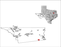
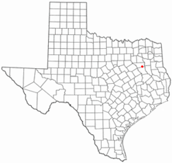 Location of Poynor, Texas | |
 | |
| Coordinates: 32°4′40″N 95°35′49″W / 32.07778°N 95.59694°WCoordinates: 32°4′40″N 95°35′49″W / 32.07778°N 95.59694°W | |
| Country | United States |
| State | Texas |
| County | Henderson |
| Area | |
| • Total | 2.4 sq mi (6.1 km2) |
| • Land | 2.4 sq mi (6.1 km2) |
| • Water | 0.0 sq mi (0.0 km2) |
| Elevation | 440 ft (134 m) |
| Population (2010) | |
| • Total | 305 |
| • Density | 129/sq mi (49.9/km2) |
| Time zone | UTC-6 (Central (CST)) |
| • Summer (DST) | UTC-5 (CDT) |
| ZIP code | 75782 |
| Area code(s) | 430, 903 |
| FIPS code | 48-59192[1] |
| GNIS feature ID | 1344473[2] |
Poynor is a town in Henderson County, Texas, United States. The population was 305 at the 2010 census.[3]
Geography
Poynor is located in southeastern Henderson County at 32°4′40″N 95°35′49″W / 32.07778°N 95.59694°W (32.077740, -95.596885),[4] along U.S. Route 175. It is 17 miles (27 km) southeast of Athens, the county seat, and 21 miles (34 km) northwest of Jacksonville.
According to the United States Census Bureau, Poynor has a total area of 2.4 square miles (6.1 km2), all of it land.[3]
Demographics
| Historical population | |||
|---|---|---|---|
| Census | Pop. | %± | |
| 1980 | 272 | — | |
| 1990 | 237 | −12.9% | |
| 2000 | 314 | 32.5% | |
| 2010 | 305 | −2.9% | |
| Est. 2016 | 305 | [5] | 0.0% |
| U.S. Decennial Census[6] | |||
As of the census[1] of 2000, there were 314 people, 112 households, and 89 families residing in the town. The population density was 132.7 people per square mile (51.2/km²). There were 121 housing units at an average density of 51.1 per square mile (19.7/km²). The racial makeup of the town was 92.68% White, 5.41% African American, 0.96% Native American, 0.32% from other races, and 0.64% from two or more races. Hispanic or Latino of any race were 4.46% of the population.
There were 112 households out of which 35.7% had children under the age of 18 living with them, 70.5% were married couples living together, 8.0% had a female householder with no husband present, and 20.5% were non-families. 16.1% of all households were made up of individuals and 11.6% had someone living alone who was 65 years of age or older. The average household size was 2.80 and the average family size was 3.09.
In the town, the population was spread out with 26.8% under the age of 18, 8.0% from 18 to 24, 27.7% from 25 to 44, 22.6% from 45 to 64, and 15.0% who were 65 years of age or older. The median age was 36 years. For every 100 females, there were 90.3 males. For every 100 females age 18 and over, there were 87.0 males.
The median income for a household in the town was $39,375, and the median income for a family was $38,750. Males had a median income of $33,125 versus $20,278 for females. The per capita income for the town was $14,829. About 13.6% of families and 10.1% of the population were below the poverty line, including 10.0% of those under age 18 and 7.8% of those age 65 or over.
Education
The town is served by the La Poynor Independent School District.
References
- 1 2 "American FactFinder". United States Census Bureau. Retrieved 2008-01-31.
- ↑ "US Board on Geographic Names". United States Geological Survey. 2007-10-25. Retrieved 2008-01-31.
- 1 2 "Geographic Identifiers: 2010 Census Summary File 1 (G001): Poynor town, Texas". American Factfinder. U.S. Census Bureau. Retrieved February 14, 2018.
- ↑ "US Gazetteer files: 2010, 2000, and 1990". United States Census Bureau. 2011-02-12. Retrieved 2011-04-23.
- ↑ "Population and Housing Unit Estimates". Retrieved June 9, 2017.
- ↑ "Census of Population and Housing". Census.gov. Retrieved June 4, 2015.
External links
- Poynor, TX from the Handbook of Texas Online
- Poynor Volunteer Fire Department website
Municipalities and communities of Henderson County, Texas, United States | ||
|---|---|---|
| Cities |  | |
| Towns | ||
| Unincorporated communities | ||
| Ghost towns | ||
| Footnotes | ‡This populated place also has portions in an adjacent county or counties | |