Powerpet
| Powerpet | |
|---|---|
| Neighbourhood | |
 | |
 Powerpet | |
| Coordinates: 16°25′28″N 81°03′36″E / 16.4245°N 81.0601°ECoordinates: 16°25′28″N 81°03′36″E / 16.4245°N 81.0601°E | |
| Country | India |
| State | Andhra Pradesh |
| District | West Godavari |
| City | Eluru |
| PIN | 534002 |
| Vehicle registration | AP-37 |
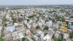
Powerpet is a suburb of Eluru city.[1] It is located in the II-town area of the city. An underpass is constructed below the railway line to connect Powerpet with 1-Town area.[2] It is named after British railway engineer Sir Power in memory of his contribution to the locality's development.[3]
Demographics
There are a total population of 10,000 persons living in 2,000 houses in Powerpet.[3]
Transport
Many Arterial roads passes through Powerpet.[4] Eluru Old bus station is situated in this locality.[5] Chennai-Kolkata National railway line divides Powerpet from 1-Town.[6] Powerpet railway station provides railway connectivity to this region.[7]
References
- ↑ Special Correspondent. "Rain poses flood threat in west Godavari". The Hindu.
- ↑ "Heavy rains lash West Godavari". Retrieved 3 June 2017.
- 1 2 "New Rail Over Bridge may take a heavy toll on Power Peta". The Hans India. 20 May 2017. Retrieved 11 August 2018.
- ↑ "EMC lays emphasis on development of roads". Retrieved 3 June 2017.
- ↑ "Chief Minister to inaugurate new bridge across Eluru canal today".
- ↑ "Traffic Gridlock Hits Eluru Hard". Retrieved 3 June 2017.
- ↑ "Ten villages to be merged with Eluru civic body".
This article is issued from
Wikipedia.
The text is licensed under Creative Commons - Attribution - Sharealike.
Additional terms may apply for the media files.