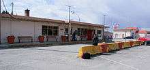
Powell River Airport
| Powell River Airport | |||||||||||
|---|---|---|---|---|---|---|---|---|---|---|---|
 | |||||||||||
| Summary | |||||||||||
| Airport type | Public | ||||||||||
| Operator | District of Powell River | ||||||||||
| Location | Powell River, British Columbia | ||||||||||
| Time zone | PST (UTC−08:00) | ||||||||||
| • Summer (DST) | PDT (UTC−07:00) | ||||||||||
| Elevation AMSL | 425 ft / 130 m | ||||||||||
| Coordinates | 49°50′03″N 124°30′01″W / 49.83417°N 124.50028°WCoordinates: 49°50′03″N 124°30′01″W / 49.83417°N 124.50028°W | ||||||||||
| Map | |||||||||||
 CYPW Location in British Columbia | |||||||||||
| Runways | |||||||||||
| |||||||||||
| Statistics | |||||||||||
| |||||||||||
Powell River Airport, (IATA: YPW, ICAO: CYPW), is located adjacent to Powell River, British Columbia, Canada. In 2011, the airport had approximately 39,422 passenger departures and arrivals.
Airlines and destinations
| Airlines | Destinations |
|---|---|
| KD Air | Qualicum Beach |
| Pacific Coastal Airlines | Vancouver |
References
- ↑ Canada Flight Supplement. Effective 0901Z 19 July 2018 to 0901Z 13 September 2018.
- ↑ Synoptic/Metstat Station Information
External links
| Wikimedia Commons has media related to Powell River Airport. |
- Past three hours METARs, SPECI and current TAFs for Powell River Airport from Nav Canada as available.
| By name | |
|---|---|
| By location indicator | |
| By province/territory | |
| By area | |
| National Airports System | |
| Related | |
| |
This article is issued from
Wikipedia.
The text is licensed under Creative Commons - Attribution - Sharealike.
Additional terms may apply for the media files.