Posiłek, Opole Voivodeship
| Posiłek | |
|---|---|
| Village | |
 Posiłek | |
 Posiłek | |
| Coordinates: 50°31′29″N 17°54′49″E / 50.52472°N 17.91361°E | |
| Country |
|
| Voivodeship | Opole |
| County | Krapkowice |
| Gmina | Krapkowice |
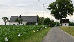
Posiłek [pɔˈɕiwɛk] (German: Waldesruh) is a village in the administrative district of Gmina Krapkowice, within Krapkowice County, Opole Voivodeship, in south-western Poland.[1] It lies approximately 8 kilometres (5 mi) north-west of Krapkowice and 16 km (10 mi) south of the regional capital Opole.
Before 1945 the area was part of Germany (see Territorial changes of Poland after World War II).
References
| Town and seat |  | |
|---|---|---|
| Villages | ||
Coordinates: 50°31′29″N 17°54′49″E / 50.52472°N 17.91361°E
This article is issued from
Wikipedia.
The text is licensed under Creative Commons - Attribution - Sharealike.
Additional terms may apply for the media files.