Ligota, Opole Voivodeship
| Ligota | |
|---|---|
| Village | |
 | |
 Ligota | |
| Coordinates: 50°26′42″N 17°59′30″E / 50.44500°N 17.99167°E | |
| Country |
|
| Voivodeship | Opole |
| County | Krapkowice |
| Gmina | Krapkowice |
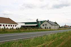
Ligota [liˈɡɔta] (German: Ellguth) is a village in the administrative district of Gmina Krapkowice, within Krapkowice County, Opole Voivodeship, in south-western Poland.[1]
Before 1945 the area was part of Germany (see Territorial changes of Poland after World War II).
| Wikimedia Commons has media related to Ligota. |
References
| Town and seat |  | |
|---|---|---|
| Villages | ||
Coordinates: 50°26′42″N 17°59′30″E / 50.44500°N 17.99167°E
This article is issued from
Wikipedia.
The text is licensed under Creative Commons - Attribution - Sharealike.
Additional terms may apply for the media files.