Posen Township, Michigan
| Posen Township, Michigan | |
|---|---|
| Township | |
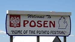 Welcome sign for the village of Posen. | |
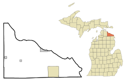 Location of Posen Township within Presque Isle County | |
_location.svg.png) Location of Posen, Michigan within Posen Township. | |
 Posen Township, Michigan Location within the state of Michigan | |
| Coordinates: 45°14′56″N 83°41′24″W / 45.24889°N 83.69000°WCoordinates: 45°14′56″N 83°41′24″W / 45.24889°N 83.69000°W | |
| Country | United States |
| State | Michigan |
| County | Presque Isle |
| Government | |
| • Type | Civil township |
| • Supervisor | James Zakshesky |
| • Clerk | Judy Szczerowski |
| Area | |
| • Total | 35.5 sq mi (92.0 km2) |
| • Land | 35.3 sq mi (91.4 km2) |
| • Water | 0.2 sq mi (0.6 km2) |
| Elevation | 781 ft (238 m) |
| Population (2000) | |
| • Total | 959 |
| • Density | 27.2/sq mi (10.5/km2) |
| Time zone | UTC-5 (Eastern (EST)) |
| • Summer (DST) | UTC-4 (EDT) |
| ZIP code | 49776 |
| Area code(s) | 989 |
| FIPS code | 26-66020[1] |
| GNIS feature ID | 1626938[2] |
Posen Township is a civil township of Presque Isle County in the U.S. state of Michigan. The population was 959, at the 2000 census, 65.4% (652) of which reported Polish ancestry.
Communities
- Posen is a village located at 45°15′46″N 83°41′55″W / 45.26278°N 83.69861°W along M-65.
Geography
According to the United States Census Bureau, the township has a total area of 35.5 square miles (92 km2), of which 35.3 square miles (91 km2) is land and 0.2 square miles (0.52 km2) (0.62%) is water.
Demographics
| Largest ancestries (2000) [3] | Percent |
|---|---|
| Polish | 65.4% |
| German | 16.9% |
| American | 4.0% |
| Irish | 3.5% |
| English | 3.4% |
| French | 3.3% |
| Languages (2000) [4][5] | Percent |
|---|---|
| Spoke English at home | 81.99% |
| Spoke Polish at home | 18.01% |
| Spoke English "not well" or "not at all." | 1.05% |
As of the census[1] of 2000, there were 959 people, 387 households, and 260 families residing in the township. The population density was 27.2 per square mile (10.5/km²). There were 463 housing units at an average density of 13.1 per square mile (5.1/km²). The racial makeup of the township was 98.12% White, 1.25% African American, and 0.63% from two or more races. Hispanic or Latino of any race were 0.31% of the population. The ancestry make up was 65.4% Polish, 16.9% German,4.0% American, 3.5% Irish, 3.4% English,3.3% French,1.4% French Canadian, 0.9% Norwegian, 0.8% Czech,0.6% Italian,0.5% Russian,0.4%Danish,0.4%Dutch,0.3%Swedish,0.2% Greek,0.2% Hungarian,0.2% Scottish,0.2% Ukrainian.
There were 387 households out of which 28.9% had children under the age of 18 living with them, 57.9% were married couples living together, 5.7% had a female householder with no husband present, and 32.6% were non-families. 28.9% of all households were made up of individuals and 15.2% had someone living alone who was 65 years of age or older. The average household size was 2.45 and the average family size was 3.05.
In the township the population was spread out with 24.2% under the age of 18, 7.9% from 18 to 24, 25.0% from 25 to 44, 23.6% from 45 to 64, and 19.3% who were 65 years of age or older. The median age was 40 years. For every 100 females, there were 103.2 males. For every 100 females age 18 and over, there were 95.4 males.
The median income for a household in the township was $31,912, and the median income for a family was $40,714. Males had a median income of $31,875 versus $23,558 for females. The per capita income for the township was $15,259. About 4.5% of families and 9.7% of the population were below the poverty line, including 9.9% of those under age 18 and 12.7% of those age 65 or over.
References
- 1 2 "American FactFinder". United States Census Bureau. Retrieved 2008-01-31.
- ↑ U.S. Geological Survey Geographic Names Information System: Posen Township, Michigan
- ↑ https://factfinder.census.gov/faces/nav/jsf/pages/index.xhtml Community fact, Posen township, Presque Isle County, Michigan Origins and language, Census 2000, Selected Social Characteristics (Household and Family Type, Disability, Citizenship, Ancestry, Language, ...)
- ↑ https://apps.mla.org/map_data_results&SRVY_YEAR=2000&geo=&state_id=26&county_id=&mode=&lang_id=&zip=&place_id=66020&cty_id=141®ion_id=&division_id=&ll=&ea=n&order=&a=n&pc=1
- ↑ https://apps.mla.org/map_data_results&SRVY_YEAR=2000&geo=&state_id=26&county_id=&mode=&lang_id=&zip=&place_id=66020&cty_id=141®ion_id=&division_id=&ll=&ea=y&order=&a=y&pc=1
Municipalities and communities of Presque Isle County, Michigan, United States | ||
|---|---|---|
| Cities |  | |
| Villages | ||
| Townships | ||
| CDP | ||
| Other unincorporated communities | ||