Posen, Michigan
| Posen, Michigan | |
|---|---|
| Village | |
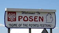 Welcome sign for Posen. | |
 Location of Posen, Michigan | |
_location.svg.png) Location of Posen, Michigan within Posen Township. | |
| Coordinates: 45°15′46″N 83°41′55″W / 45.26278°N 83.69861°W | |
| Country | United States |
| State | Michigan |
| County | Presque Isle |
| Township | Posen Township |
| Government | |
| • President | Marilyn Kaszubowski [1] |
| Area[2] | |
| • Total | 1.00 sq mi (2.59 km2) |
| • Land | 1.00 sq mi (2.59 km2) |
| • Water | 0 sq mi (0 km2) |
| Elevation | 797 ft (243 m) |
| Population (2010)[3] | |
| • Total | 234 |
| • Estimate (2016)[4] | 224 |
| • Density | 230/sq mi (90/km2) |
| Time zone | UTC-5 (Eastern (EST)) |
| • Summer (DST) | UTC-4 (EDT) |
| ZIP code | 49776 |
| Area code(s) | 989 |
| FIPS code | 26-66000[5] |
| GNIS feature ID | 0635315[6] |
| Website | http://www.posenmi.org/ |
Posen is a village in Presque Isle County of the U.S. state of Michigan. The population was 234 at the 2010 census. The village is located within Posen Township.
Posen has a strong Polish background as 56.1% of its inhabitants are reported to have Polish ancestry. It is home to the Posen Potato Festival, held every year on during the first weekend after Labor Day. The festival includes activities with potato pancakes and polka dancing. Posen has a branch of the Presque Isle District Library. Posen is also the German name for the Polish city of Poznań.
Transportation
Geography
According to the United States Census Bureau, the village has a total area of 1.00 square mile (2.59 km2), all land.[2]
Demographics
| Historical population | |||
|---|---|---|---|
| Census | Pop. | %± | |
| 1910 | 263 | — | |
| 1920 | 190 | −27.8% | |
| 1930 | 219 | 15.3% | |
| 1940 | 239 | 9.1% | |
| 1950 | 274 | 14.6% | |
| 1960 | 341 | 24.5% | |
| 1970 | 339 | −0.6% | |
| 1980 | 270 | −20.4% | |
| 1990 | 263 | −2.6% | |
| 2000 | 292 | 11.0% | |
| 2010 | 234 | −19.9% | |
| Est. 2016 | 224 | [4] | −4.3% |
| U.S. Decennial Census[7] | |||
2010 census
| Largest ancestries (2010) [8] | Percent |
|---|---|
| Polish | 78.8% |
| German | 16.9% |
| English | 7.5% |
| Irish | 7.1% |
| Danish | 2.0% |
| French Canadian | 1.6% |
As of the census[3] of 2010, there were 234 people, 110 households, and 54 families residing in the village. The population density was 234.0 inhabitants per square mile (90.3/km2). There were 144 housing units at an average density of 144.0 per square mile (55.6/km2). The racial makeup of the village was 96.2% White, 1.3% Native American, 0.4% Pacific Islander, and 2.1% from two or more races.
There were 110 households of which 23.6% had children under the age of 18 living with them, 36.4% were married couples living together, 8.2% had a female householder with no husband present, 4.5% had a male householder with no wife present, and 50.9% were non-families. 42.7% of all households were made up of individuals and 27.3% had someone living alone who was 65 years of age or older. The average household size was 2.07 and the average family size was 2.96.
The median age in the village was 46 years. 22.2% of residents were under the age of 18; 5.2% were between the ages of 18 and 24; 21.7% were from 25 to 44; 27.3% were from 45 to 64; and 23.5% were 65 years of age or older. The gender makeup of the village was 46.2% male and 53.8% female.
2000 census
| Largest ancestries (2000) [9] | Percent |
|---|---|
| Polish | 56.1% |
| German | 15.3% |
| American | 7.8% |
| French | 3.1% |
| English | 2.5% |
| French Canadian | 1.6% |
| Languages (2000) [10][11] | Percent |
|---|---|
| Spoke English at home | 84.78% |
| Spoke Polish at home | 15.22% |
| Spoke English "not well" or "not at all." | 1.63% |
As of the census[5] of 2000, there were 292 people, 126 households, and 73 families residing in the village. The population density was 291.6 per square mile (112.7/km²). There were 138 housing units at an average density of 137.8 per square mile (53.3/km²). The racial makeup of the village was 94.18% White, 3.77% African American, and 2.05% from two or more races. Hispanic or Latino of any race were 0.34% of the population. 56.1% was of Polish, 15.3% German, 7.8% American, 3.1% French, 2.5% English, 1.6% French-Canadian, 1.2% Danish, 1.2% Irish, and 0.9% Russian ancestry.
There were 126 households out of which 25.4% had children under the age of 18 living with them, 43.7% were married couples living together, 7.9% had a female householder with no husband present, and 41.3% were non-families. 36.5% of all households were made up of individuals and 24.6% had someone living alone who was 65 years of age or older. The average household size was 2.24 and the average family size was 2.92.
In the village, the population was spread out with 23.6% under the age of 18, 8.9% from 18 to 24, 26.4% from 25 to 44, 16.1% from 45 to 64, and 25.0% who were 65 years of age or older. The median age was 39 years. For every 100 females, there were 97.3 males. For every 100 females age 18 and over, there were 85.8 males.
The median income for a household in the village was $27,969, and the median income for a family was $39,250. Males had a median income of $26,406 versus $24,250 for females. The per capita income for the village was $12,708. About 8.9% of families and 19.3% of the population were below the poverty line, including 20.0% of those under the age of eighteen and 18.8% of those sixty five or over.
References
- ↑ "Village Officials - Welcome to Posen, Mi".
- 1 2 "US Gazetteer files 2010". United States Census Bureau. Archived from the original on July 14, 2012. Retrieved November 25, 2012.
- 1 2 "American FactFinder". United States Census Bureau. Retrieved November 25, 2012.
- 1 2 "Population and Housing Unit Estimates". Retrieved June 9, 2017.
- 1 2 "American FactFinder". United States Census Bureau. Retrieved January 31, 2008.
- ↑ "US Board on Geographic Names". United States Geological Survey. October 25, 2007. Retrieved January 31, 2008.
- ↑ "Census of Population and Housing". Census.gov. Retrieved June 4, 2015.
- ↑ https://factfinder.census.gov/faces/nav/jsf/pages/index.xhtml Community fact,Posen village, Michigan, Origins and language, Census 2010, Selected Social Characteristics (Household and Family Type, Disability, Citizenship, Ancestry, Language, ...)
- ↑ https://factfinder.census.gov/faces/nav/jsf/pages/index.xhtml Community fact,Posen village, Michigan, Origins and language, Census 2000, Selected Social Characteristics (Household and Family Type, Disability, Citizenship, Ancestry, Language, ...)
- ↑ https://apps.mla.org/map_data_results&SRVY_YEAR=2000&geo=&state_id=26&county_id=&mode=&lang_id=&zip=&place_id=66000&cty_id=®ion_id=&division_id=&ll=&ea=n&order=&a=n&pc=1
- ↑ https://apps.mla.org/map_data_results&SRVY_YEAR=2000&geo=&state_id=26&county_id=&mode=&lang_id=&zip=&place_id=66000&cty_id=®ion_id=&division_id=&ll=&ea=y&order=r&a=y&pc=1
Municipalities and communities of Presque Isle County, Michigan, United States | ||
|---|---|---|
| Cities |  | |
| Villages | ||
| Townships | ||
| CDP | ||
| Other unincorporated communities | ||
Coordinates: 45°15′43″N 83°41′56″W / 45.26194°N 83.69889°W