Port Anderson, Mississippi
| Port Anderson, Mississippi | |
|---|---|
| Ghost town | |
|
1862 map showing Port Anderson
| |
 Port Anderson, Mississippi Location within the state of Mississippi  Port Anderson, Mississippi Port Anderson, Mississippi (the US) | |
| Coordinates: 33°31′33″N 91°12′06″W / 33.52583°N 91.20167°WCoordinates: 33°31′33″N 91°12′06″W / 33.52583°N 91.20167°W | |
| Country | United States |
| State | Mississippi |
| County | Washington |
| Elevation | 102 ft (31 m) |
| Time zone | UTC-6 (Central (CST)) |
| • Summer (DST) | UTC-5 (CDT) |
| GNIS feature ID | 687289[1] |
.jpg)
Port Anderson is a ghost town in Washington County, Mississippi, United States.
History
The area was settled around 1820 on the banks of the Mississippi River by Major John Lewis Martin (a nephew of Meriwether Lewis), and his son-in-law, John Anderson. Using slave labor, they established a successful plantation there.[2][3]
Port Anderson is today covered by the Mississippi River, and the nearby shore is uninhabited bottomland.
References
- ↑ U.S. Geological Survey Geographic Names Information System: Port Anderson (historical)
- ↑ County Historical Society (1954). McCain, William D.; Capers, Charlotte, eds. Some Washington County Genealogy (PDF). Memoirs of Henry Tillinghast Ireys: Papers of the Washington County Historical Society, 1910-1915. Mississippi Department of Archives and History and Mississippi Historical Society. p. 340.
- ↑ Tyson, Margaret. "John Lewis Martin History". MSGenWeb. Retrieved February 8, 2017.
Municipalities and communities of Washington County, Mississippi, United States | ||
|---|---|---|
| Cities | 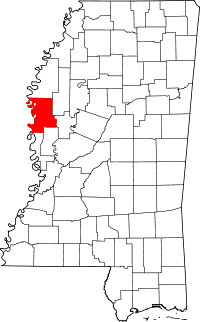 | |
| Towns | ||
| Unincorporated communities | ||
| Ghost towns | ||
This article is issued from
Wikipedia.
The text is licensed under Creative Commons - Attribution - Sharealike.
Additional terms may apply for the media files.