Pomona, Missouri
| Pomona, Missouri | |
|---|---|
| Census-designated place | |
 Pomona  Pomona | |
| Coordinates: 36°52′2″N 91°54′51″W / 36.86722°N 91.91417°WCoordinates: 36°52′2″N 91°54′51″W / 36.86722°N 91.91417°W | |
| Country | United States |
| State | Missouri |
| County | Howell |
| Area[1] | |
| • Total | 3.57 sq mi (9.25 km2) |
| • Land | 3.57 sq mi (9.24 km2) |
| • Water | 0.004 sq mi (0.01 km2) |
| Elevation | 1,250 ft (380 m) |
| Population (2010)[1] | |
| • Total | 511 |
| • Density | 143/sq mi (55.3/km2) |
| Time zone | UTC-6 (Central (CST)) |
| • Summer (DST) | UTC-5 (CDT) |
| Area code(s) | 417 |
| FIPS code | 29-58934[1] |
| GNIS feature ID | 0751693[2] |
Pomona is an unincorporated community and census-designated place (CDP) in Howell County, Missouri, United States.[3] It is located midway between Willow Springs and West Plains. As of the 2010 census it had a population of 511.[1]
A post office called Pomona has been in operation since 1895.[4] The community was named for Pomona,[5] the Roman goddess of fruit trees; this area was a major producer of apples.[6]
References
- 1 2 3 4 "Geographic Identifiers: 2010 Census Summary File 1 (G001): Pomona CDP, Missouri". American Factfinder. U.S. Census Bureau. Retrieved August 21, 2017.
- ↑ U.S. Geological Survey Geographic Names Information System: Pomona, Missouri
- ↑ U.S. Geological Survey Geographic Names Information System: Pomona, Missouri
- ↑ "Post Offices". Jim Forte Postal History. Retrieved 10 October 2016.
- ↑ Eaton, David Wolfe (1916). How Missouri Counties, Towns and Streams Were Named. The State Historical Society of Missouri. p. 176.
- ↑ "Howell County Place Names, 1928–1945 (archived)". The State Historical Society of Missouri. Archived from the original on 24 June 2016. Retrieved 10 October 2016.
Municipalities and communities of Howell County, Missouri, United States | ||
|---|---|---|
| Cities | 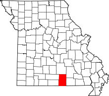 | |
| Townships | ||
| CDPs | ||
| Other unincorporated communities | ||
| Ghost towns | ||
This article is issued from
Wikipedia.
The text is licensed under Creative Commons - Attribution - Sharealike.
Additional terms may apply for the media files.