Fruitville, Missouri
Fruitville is an unincorporated community in southeast Howell County, in the U.S. state of Missouri.[1]
The community was located about eight miles southeast of West Plains south of Missouri Route PP along a county road on the east bank of Myatt Creek. The Meltabarger Cemetery is near the site.[2]
History
A post office called Fruitville was established in 1910, and remained in operation until 1921.[3] The community was named for its location in a fruit-growing district.[4] The area was promoted as a fruit growing area as Torreytown or Fruitville in 1910 by Col. Jay L. Torrey.[5]
References
- ↑ U.S. Geological Survey Geographic Names Information System: Fruitville, Missouri
- ↑ Lanton, Missouri 7.5 Minute Topographic Quadrangle, USGS, 1983
- ↑ "Post Offices". Jim Forte Postal History. Archived from the original on 10 April 2015. Retrieved 10 October 2016.
- ↑ "Howell County Place Names, 1928–1945 (archived)". The State Historical Society of Missouri. Archived from the original on 24 June 2016. Retrieved 10 October 2016.
- ↑ Fruitville Farm Pamphlet, Missouri Historical Society
Municipalities and communities of Howell County, Missouri, United States | ||
|---|---|---|
| Cities | 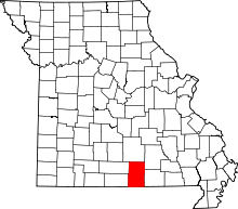 | |
| Townships | ||
| CDPs | ||
| Other unincorporated communities | ||
| Ghost towns | ||
Coordinates: 36°36′58″N 91°45′56″W / 36.61611°N 91.76556°W
This article is issued from
Wikipedia.
The text is licensed under Creative Commons - Attribution - Sharealike.
Additional terms may apply for the media files.