Polharrow Burn
| Polharrow Burn | |
| River | |
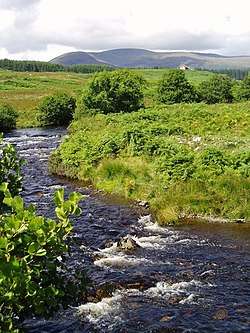 The Polharrow Burn and Green House | |
| Countries | United Kingdom, Scotland |
|---|---|
| Region | Dumfries and Galloway |
| District | Kirkcudbrightshire |
| Tributaries | |
| - left | Lumford Burn, Polcardie Burn |
| - right | Burnhead Burn, Largvey Burn, Crummy Burn |
| Source | Loch Harrow |
| - location | Knocknalling, Dumfries and Galloway, Scotland |
| - elevation | 250 m (820 ft) |
| - coordinates | 55°09′09″N 4°18′42″W / 55.152413°N 4.311631°W |
| Mouth | |
| - location | Water of Ken |
| - elevation | 83 m (272 ft) |
| - coordinates | 55°08′02″N 4°11′30″W / 55.1338°N 4.1917°WCoordinates: 55°08′02″N 4°11′30″W / 55.1338°N 4.1917°W |
| Length | 8.6 km (5 mi) |
Polharrow Burn is a small watercourse in Kirkcudbrightshire, Galloway , Scotland, which rises in Loch Harrow and flows towards St John's Town of Dalry before joining the Water of Ken.[1]
It gives its name to a Scottish country dance by the cryptographer and Scottish country dance deviser Hugh Foss, which appeared in his Glendarroch Scottish Country Dance Collection in 1966. He lived in his retirement at Glendarroch in St John's Town of Dalry and died in 1971.[2]
References
- ↑ "Polharrow Burn from The Gazetteer for Scotland". Retrieved 2 September 2018.
- ↑ "Polharrow Burn". Scottish Country Dancing Dictionary. Retrieved 2 September 2018.
This article is issued from
Wikipedia.
The text is licensed under Creative Commons - Attribution - Sharealike.
Additional terms may apply for the media files.