Pointe aux Chenes River
| Pointe aux Chenes River | |
|---|---|
 | |
| Country | United States |
| Physical characteristics | |
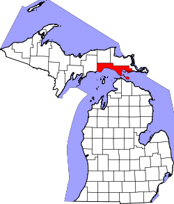
| Main source | Michigan |
| River mouth | 45°54′58″N 84°52′45″W / 45.91611°N 84.87917°WCoordinates: 45°54′58″N 84°52′45″W / 45.91611°N 84.87917°W |
The Pointe aux Chenes River is a 6.2-mile-long (10.0 km)[1] river on the Upper Peninsula of Michigan in the United States. It begins at the outlet of Round Lake and flows south in a winding course through the extensive Pointe aux Chenes Marshes to Lake Michigan.
See also
References
- ↑ U.S. Geological Survey. National Hydrography Dataset high-resolution flowline data. The National Map, accessed December 19, 2011
This article is issued from
Wikipedia.
The text is licensed under Creative Commons - Attribution - Sharealike.
Additional terms may apply for the media files.