Plura (river)
| Plura | |
|---|---|
 | |
| Country | Norway |
| Physical characteristics | |
| Main source |
Kallvatnet 564 m (1,850 ft) above sea level |
| River mouth |
Ranelva 19 m (62 ft) above sea level |
| Length | 27 km (17 mi) |
| Basin features | |
| River system | Ranelva |
| Basin size | 437 km2 (169 sq mi) |
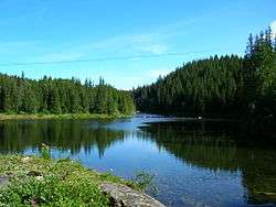
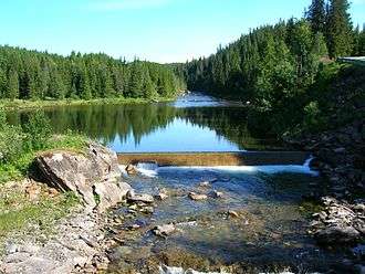
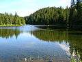
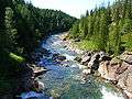
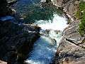
Plura is a river in the municipality of Rana in Nordland county, Norway. The river begins at the lake Kallvatnet, flows through the Plurdalen valley, and ends up as a tributary to the river Ranelva, about 10 kilometres (6.2 mi) north of the town of Mo i Rana. The river is rich with salmon, trout, and Arctic char. The name comes from the Norwegian verb "prula" which means "boiling" or "seething".[1]
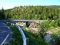
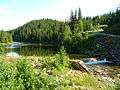
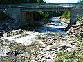
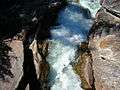
The Plura river flows both over and beneath the ground, and it has the longest subterranean flow in Norway at 3.8 kilometres (2.4 mi). Until 1964, Plura was a large river, washing limestone out of the mountain, creating several caves/tunnels down through the Plurdalen valley. Through the Pluragrotta cave, about 20,000 cubic metres (710,000 cu ft) of water passed each minute. The Kallvatnet dam made the river Plura almost dry, and the water in Pluragrotta cave became standing still like in a water seal.
Media gallery


References
| Wikimedia Commons has media related to Plura. |
- ↑ Store norske leksikon. "Plura" (in Norwegian). Retrieved 2011-12-20.
Coordinates: 66°20′N 14°20′E / 66.333°N 14.333°E