Plesná (Cheb District)
| Plesná | |||
| Town | |||
 | |||
|
|||
| Country | Czech Republic | ||
|---|---|---|---|
| Region | Karlovy Vary | ||
| District | Cheb | ||
| Commune | Cheb | ||
| Elevation | 499 m (1,637 ft) | ||
| Coordinates | 50°13′N 12°20′E / 50.217°N 12.333°ECoordinates: 50°13′N 12°20′E / 50.217°N 12.333°E | ||
| Area | 19.26 km2 (7.44 sq mi) | ||
| Population | 1,953 (2016) | ||
| Density | 101/km2 (262/sq mi) | ||
| Mayor | Petr Schaller | ||
| Timezone | CET (UTC+1) | ||
| - summer (DST) | CEST (UTC+2) | ||
| Postal code | 351 35 | ||
  Location in the Czech Republic | |||
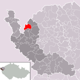 Location in Cheb District | |||
| Wikimedia Commons: Plesná (Cheb District) | |||
| Statistics: statnisprava.cz | |||
| Website: www | |||

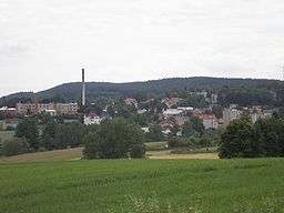
Plesná (German: Fleißen) is a town in the Czech Republic.
History
The first written record of the town dates back to 1185, when it belonged to Waldsassen Abbey. The population was 1,953 inhabitants in 2016[1].
Local districts
- Lomnička (Lomnička u Plesné)
- Plesná (Plesná a Šneky)
- Smrčina
- Vackov
Sights
- There are ruins of Neuhaus castle located approximately two kilometres to the south of the town. It could be a mansion of ministeriales of Plesná mentioned in 1197, but according to another source, it is a different mansion of unknown origin[2][3].
- Crucifix.
Gallery
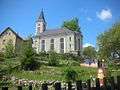 Church
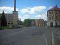
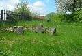 Stone circle
References
- ↑ "Czech Statistical Office". Počet obyvatel v obcích k 1.1.2016. 2016-04-29. Archived from the original on 2016-04-29. Retrieved 2017-05-01.
- ↑ DURDÍK, Tomáš (2002). Ilustrovaná encyklopedie českých hradů. Prague: Libri. 736 p. pp. 377–378. ISBN 80-7277-003-9.
- ↑ DURDÍK, Tomáš (2011). Ilustrovaná encyklopedie českých hradů: Dodatky 4. Prague: Libri. 164 p. pp. 75–76. ISBN 978-80-7277-489-0.
External links

- Municipal website
This article is issued from
Wikipedia.
The text is licensed under Creative Commons - Attribution - Sharealike.
Additional terms may apply for the media files.