Pleasure Bend, Louisiana
| Pleasure Bend, Louisiana | |
|---|---|
| Unincorporated community | |
 Pleasure Bend, Louisiana  Pleasure Bend, Louisiana | |
| Coordinates: 29°55′14″N 90°38′45″W / 29.92056°N 90.64583°WCoordinates: 29°55′14″N 90°38′45″W / 29.92056°N 90.64583°W | |
| Country | United States |
| State | Louisiana |
| Parish | St. John the Baptist |
| Area[1] | |
| • Total | 4.228 sq mi (10.95 km2) |
| • Land | 4.144 sq mi (10.73 km2) |
| • Water | 0.084 sq mi (0.22 km2) |
| Elevation | 0 ft (0 m) |
| Population (2010)[1] | |
| • Total | 250 |
| • Density | 59/sq mi (23/km2) |
| Time zone | UTC-6 (Central (CST)) |
| • Summer (DST) | UTC-5 (CDT) |
| Area code(s) | 985 |
| GNIS feature ID | 2583545[2] |
Pleasure Bend is an unincorporated community and census-designated place in St. John the Baptist Parish, Louisiana, United States. Its population was 250 as of the 2010 census.[1]
Geography
According to the U.S. Census Bureau, the community has an area of 4.228 square miles (10.95 km2); 4.144 square miles (10.73 km2) of its area is land, and 0.084 square miles (0.22 km2) is water.[1]
References
Municipalities and communities of St. John the Baptist Parish, Louisiana, United States | ||
|---|---|---|
| CDPs | 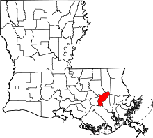 | |
| Unincorporated communities | ||
| Ghost town | ||
| Footnotes | ‡This populated place also has portions in an adjacent parish | |
This article is issued from
Wikipedia.
The text is licensed under Creative Commons - Attribution - Sharealike.
Additional terms may apply for the media files.