Pleasant Ridge, Wisconsin
| Pleasant Ridge, Wisconsin | |
|---|---|
| Unincorporated community | |
 Pleasant Ridge  Pleasant Ridge | |
| Coordinates: 43°03′17″N 90°04′24″W / 43.05472°N 90.07333°WCoordinates: 43°03′17″N 90°04′24″W / 43.05472°N 90.07333°W | |
| Country | United States |
| State | Wisconsin |
| County | Iowa |
| Town | Dodgeville |
| Elevation | 1,247 ft (380 m) |
| Time zone | UTC-6 (Central (CST)) |
| • Summer (DST) | UTC-5 (CDT) |
| Area code(s) | 608 |
| GNIS feature ID | 1577773[1] |
Pleasant Ridge is an unincorporated community located in the town of Dodgeville, Iowa County, Wisconsin, United States. Pleasant Ridge is located at the intersection of County Highways Z and ZZ 7 miles (11 km) north-northeast of the city of Dodgeville.[2]
References
- ↑ U.S. Geological Survey Geographic Names Information System: Pleasant Ridge, Wisconsin
- ↑ Iowa County (PDF) (Map). Wisconsin Department of Transportation. 2011. Archived from the original (PDF) on January 30, 2012. Retrieved October 9, 2011.
Municipalities and communities of Iowa County, Wisconsin, United States | ||
|---|---|---|
| Cities | 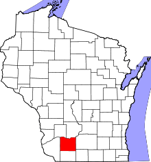 | |
| Villages | ||
| Towns | ||
| CDP | ||
| Unincorporated communities | ||
| Ghost towns | ||
| Footnotes | ‡This populated place also has portions in an adjacent county or counties | |
This article is issued from
Wikipedia.
The text is licensed under Creative Commons - Attribution - Sharealike.
Additional terms may apply for the media files.