Pleasant Hill, Scott County, Arkansas
| Pleasant Hill, Arkansas | |
|---|---|
| Unincorporated community | |
 Pleasant Hill, Arkansas  Pleasant Hill, Arkansas | |
| Coordinates: 34°54′16″N 94°07′26″W / 34.90444°N 94.12389°WCoordinates: 34°54′16″N 94°07′26″W / 34.90444°N 94.12389°W | |
| Country | United States |
| State | Arkansas |
| County | Scott |
| Elevation | 686 ft (209 m) |
| Time zone | UTC-6 (Central (CST)) |
| • Summer (DST) | UTC-5 (CDT) |
| Area code(s) | 479 |
| GNIS feature ID | 66324[1] |
Pleasant Hill is an unincorporated community in Scott County, Arkansas, United States. Pleasant Hill is located on Arkansas Highway 80, 1.9 miles (3.1 km) west of Waldron.[2]
References
- ↑ "Pleasant Hill". Geographic Names Information System. United States Geological Survey.
- ↑ Scott County, Arkansas General Highway Map (PDF) (Map). Arkansas State Highway and Transportation Department. 1999. Retrieved June 21, 2012.
Municipalities and communities of Scott County, Arkansas, United States | ||
|---|---|---|
| Cities | 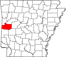 | |
| Unincorporated communities | ||
| Ghost town | ||
| Footnotes | ‡This populated place also has portions in an adjacent county or counties | |
This article is issued from
Wikipedia.
The text is licensed under Creative Commons - Attribution - Sharealike.
Additional terms may apply for the media files.