Pirarajá
| Pirarajá | |
|---|---|
| Village | |
 Pirarajá Location in Uruguay | |
| Coordinates: 33°44′25″S 54°45′30″W / 33.74028°S 54.75833°WCoordinates: 33°44′25″S 54°45′30″W / 33.74028°S 54.75833°W | |
| Country |
|
| Department | Lavalleja Department |
| Population (2011) | |
| • Total | 713 |
| Time zone | UTC -3 |
| Postal code | 30002 |
| Dial plan | +598 4448 (+4 digits) |
Pirarajá is a village in the Lavalleja Department of southeastern Uruguay.
Location
It is located on Route 8 and on its junction with Route 58, about 34 kilometres (21 mi) north of Mariscala and 95 kilometres (59 mi) northeast of Minas.
History
Its status was elevated to "Pueblo" (village) on 22 December 1906 by decree Ley Nº 3.136.[1]
Population
In 2011 Pirarajá had a population of 713.[2]
| Year | Population |
|---|---|
| 1963 | 914 |
| 1975 | 910 |
| 1985 | 773 |
| 1996 | 737 |
| 2004 | 967 |
| 2011 | 713 |
Source: Instituto Nacional de Estadística de Uruguay[1]
References
- 1 2 "Statistics of urban localities (1963–2004)" (PDF). INE. 2012. Retrieved 4 September 2012.
- ↑ "Censos 2011 Lavalleja (needs flash plugin)". INE. 2012. Retrieved 31 August 2012.
External links
Capital: Minas | ||
| Towns and villages | 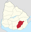 | |
| Sights | ||
This article is issued from
Wikipedia.
The text is licensed under Creative Commons - Attribution - Sharealike.
Additional terms may apply for the media files.