Phippsburg, Colorado
| Phippsburg, Colorado | |
|---|---|
| CDP | |
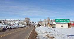 Entering Phippsburg on State Highway 131 | |
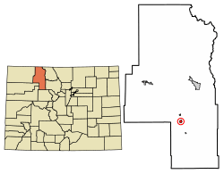 Location of Phippsburg in Routt County, Colorado. | |
 Location in Routt County and the state of Colorado | |
| Coordinates: 40°13′56″N 106°56′35″W / 40.23222°N 106.94306°WCoordinates: 40°13′56″N 106°56′35″W / 40.23222°N 106.94306°W | |
| Country |
|
| State |
|
| County | Routt[1] |
| Elevation[1] | 7,438 ft (2,267 m) |
| Time zone | UTC-7 (MST) |
| • Summer (DST) | UTC-6 (MDT) |
| ZIP code[2] | 80469 |
| GNIS feature ID | 0173063 |
Phippsburg is a census-designated place and a U.S. Post Office in Routt County, Colorado, United States. The population as of the 2010 Census was 204.[3] The Phippsburg Post Office has the ZIP Code 80469.[2]
A post office called Phippsburg has been in operation since 1909.[4] The community was named after Lawrence C. Phipps, a Colorado legislator.[5]
Geography
Phippsburg is located at 40°13′56″N 106°56′35″W / 40.23222°N 106.94306°W (40.232102,-106.943150).
Demographics
| Historical population | |||
|---|---|---|---|
| Census | Pop. | %± | |
| U.S. Decennial Census[6] | |||
See also
References
- 1 2 "US Board on Geographic Names". United States Geological Survey. 2007-10-25. Retrieved 2008-01-31.
- 1 2 "ZIP Code Lookup" (JavaScript/HTML). United States Postal Service. January 2, 2007. Retrieved January 2, 2007.
- ↑ Colorado Trend Report 2: State and Complete Places (Sub-state 2010 Census Data). Missouri Census Data Center. Accessed 2011-02-25.
- ↑ "Post offices". Jim Forte Postal History. Retrieved 7 July 2016.
- ↑ Dawson, John Frank. Place names in Colorado: why 700 communities were so named, 150 of Spanish or Indian origin. Denver, CO: The J. Frank Dawson Publishing Co. p. 40.
- ↑ "Census of Population and Housing". Census.gov. Retrieved June 4, 2016.
Municipalities and communities of Routt County, Colorado, United States | ||
|---|---|---|
| City | 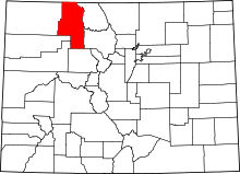 | |
| Towns | ||
| CDP | ||
| Unincorporated communities | ||
| Ghost towns | ||
This article is issued from
Wikipedia.
The text is licensed under Creative Commons - Attribution - Sharealike.
Additional terms may apply for the media files.