Pharr–Reynosa International Bridge
| Pharr–Reynosa International Bridge | |
|---|---|
| Coordinates | 26°04′N 98°13′W / 26.07°N 98.21°WCoordinates: 26°04′N 98°13′W / 26.07°N 98.21°W |
| Carries | U.S. Route 281 |
| Crosses |
Rio Grande, Mexico—U.S. border |
| Locale |
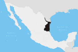
Pharr, Texas, United States; Reynosa, Tamaulipas state, Mexico |
| Characteristics | |
| Total length | 5 kilometres (3.1 mi) |
The Pharr–Reynosa International Bridge crosses the Rio Grande and U.S.-Mexico border. It connects the city of Pharr in Texas with the city of Reynosa and Mexican Federal Highway 2 in Tamaulipas state, Mexico
The bridge handles commercial vehicles as well as passenger vehicles. It serves as an important port of entry into the U.S. Since 1996, all trucks have been diverted here from the McAllen–Hidalgo–Reynosa International Bridge on the west−upriver.
With a 5 km (3 mi) length, it is the longest international bridge connecting two countries in the world.[1]
The bridge connects to U.S. Route 281 via Texas State Highway Spur 600.
.jpg)
U.S. Pharr International Bridge cargo facility agents intercepted a package of cocaine within a bag of carrots in a commercial fresh produce shipment.
See also
- Bridges over the Rio Grande
- International bridges in Tamaulipas
References
- ↑ "Pharr-Reynosa Intl Bridge". City of Pharr, Texas. Retrieved August 14, 2016.
Coordinates: 26°04′01″N 98°12′19″W / 26.06683°N 98.20518°W
This article is issued from
Wikipedia.
The text is licensed under Creative Commons - Attribution - Sharealike.
Additional terms may apply for the media files.