Phan Thong District
| Phan Thong พานทอง | |
|---|---|
| Amphoe | |
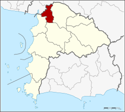 Amphoe location in Chonburi Province | |
| Coordinates: 13°28′14″N 101°5′49″E / 13.47056°N 101.09694°ECoordinates: 13°28′14″N 101°5′49″E / 13.47056°N 101.09694°E | |
| Country |
|
| Province | Chonburi |
| Seat | Phan Thong |
| Tambon | 11 |
| Muban | 76 |
| Area | |
| • Total | 173.0 km2 (66.8 sq mi) |
| Population (2015) | |
| • Total | 62,593 |
| • Density | 361.80/km2 (937.1/sq mi) |
| Time zone | UTC+7 (THA) |
| Postal code | 20160 |
| Geocode | 2005 |
Phan Thong (Thai: พานทอง, pronounced [pʰāːn tʰɔ̄ːŋ]) is a district (amphoe) of the province of Chon Buri in Thailand.
Neighbouring districts are (from north clockwise) Bang Pakong, Ban Pho (both Chachoengsao Province), Phanat Nikhom, Ban Bueng and Mueang Chon Buri.
Administration
Central administration
The district Phan Thong is subdivided into 11 subdistricts (Tambon), which are further subdivided into 76 administrative villages (Muban).
| No. | Name | Thai | Villages | Pop.[1] |
|---|---|---|---|---|
| 1. | Phan Thong | พานทอง | 10 | 10,160 |
| 2. | Nong Tamlueng | หนองตำลึง | 9 | 10,191 |
| 3. | Map Pong | มาบโป่ง | 10 | 8,137 |
| 4. | Nong Kakha | หนองกะขะ | 5 | 5,888 |
| 5. | Nong Hong | หนองหงษ์ | 6 | 5,999 |
| 6. | Khok Khi Non | โคกขี้หนอน | 5 | 3,189 |
| 7. | Ban Kao | บ้านเก่า | 7 | 3,597 |
| 8. | Na Pradu | หน้าประดู่ | 5 | 2,655 |
| 9. | Bang Nang | บางนาง | 9 | 6,571 |
| 10. | Ko Loi | เกาะลอย | 6 | 2,614 |
| 11. | Bang Hak | บางหัก | 4 | 1,195 |
Local administration
There are 2 subdistrict municipalities (Thesaban Tambon) in the district:
- Phan Thong (Thai: เทศบาลตำบลพานทอง) consisting of parts of the subdistrict Phan Thong.
- Nong Tamlueng (Thai: เทศบาลตำบลหนองตำลึง) consisting of the complete subdistrict Nong Tamlueng and parts of the subdistricts Map Pong and Nong Kakha.
There are 8 subdistrict administrative organisations (SAO) in the district:
- Phan Thong Nong Kakha (Thai: องค์การบริหารส่วนตำบลพานทองหนองกะขะ) consisting of parts of the subdistricts Phan Thong and Nong Kakha.
- Map Pong (Thai: องค์การบริหารส่วนตำบลมาบโป่ง) consisting of parts of the subdistrict Map Pong.
- Nong Hong (Thai: องค์การบริหารส่วนตำบลหนองหงษ์) consisting of the complete subdistrict Nong Hong.
- Khok Khi Non (Thai: องค์การบริหารส่วนตำบลโคกขี้หนอน) consisting of the complete subdistrict Khok Khi Non.
- Ban Kao (Thai: องค์การบริหารส่วนตำบลบ้านเก่า) consisting of the complete subdistrict Ban Kao.
- Na Pradu (Thai: องค์การบริหารส่วนตำบลหน้าประดู่) consisting of the complete subdistrict Na Pradu.
- Bang Nang (Thai: องค์การบริหารส่วนตำบลบางนาง) consisting of the complete subdistrict Bang Nang.
- Ko Loi Bang Hak (Thai: องค์การบริหารส่วนตำบลเกาะลอยบางหัก) consisting of the complete subdistricts Ko Loi and Bang Hak.
References
- ↑ "Population statistics 2014" (in Thai). Department of Provincial Administration. Retrieved 2015-08-27.
This article is issued from
Wikipedia.
The text is licensed under Creative Commons - Attribution - Sharealike.
Additional terms may apply for the media files.