Peter I Range
| Peter I Range Хребет Петра I | |
|---|---|
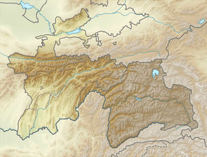 Location in Tajikistan | |
| Highest point | |
| Peak | Moscow Peak |
| Elevation | 6,785 m (22,260 ft) |
| Coordinates | 39°0′N 71°30′E / 39.000°N 71.500°ECoordinates: 39°0′N 71°30′E / 39.000°N 71.500°E |
| Dimensions | |
| Length | 200 km (120 mi) E/W |
| Width | 40 km (25 mi) N/S |
| Geography | |
| Country | Tajikistan |
| Parent range | Pamir Mountains |
| Geology | |
| Age of rock | Mesozoic/Cenozoic |
| Type of rock | Sandstone and conglomerate |
Peter I Range, Peter the First Range[1] or Peter the Great Range (Russian: Хребет Петра I or Хребет Петра Первого) is a mountain range in Tajikistan, part of the Pamir Mountain System. The range takes its name from Peter the Great (1672 – 1725).
Geography
Peter I Range is located in the south-east of Jirgatol district in Tajikistan's Region of Republican Subordination. It forms a westerly extension of the northern Pamirs, separating the watersheds of the Surchob in the north and the Obikhingou river in the south. The range stretches in a roughly East-West direction for about 200 km, connecting with the Academy of Sciences Range at its eastern end.[2]
Peaks
Its highest summit is Moscow Peak (6,785 m). Other peaks are Leningrad Peak (6,507 m), Abalakov Peak (6,446 m), Oshanin Peak (6,389 m), Kirov Peak (6,372 m), Kuybyshev Peak (6,189 m), and the ultra-prominent Agassiz Peak (5,877 m).[3]
See also
References
- ↑ Hamburger et al. Peter I range, GSA Bull., 1992
- ↑ Peter I Range - article from the Great Soviet Encyclopedia
- ↑ Yevgeniy Gippenreiter, Vladimir Shataev. "Six and Seventhousanders of the Tien Shan and the Pamirs" (PDF 4,6 MB). Alpine Journal, 1996, 122–130.
External links
Capital: Dushanbe | ||
| Districts |  | |
| Main cities and towns | ||
| Geography | ||