Perumathur
| Perumathur | |
|---|---|
| Village | |
 | |
 Perumathur Location in Tamil Nadu, India  Perumathur Perumathur (India) | |
| Coordinates: 11°20′22″N 79°01′07″E / 11.339541°N 79.018575°ECoordinates: 11°20′22″N 79°01′07″E / 11.339541°N 79.018575°E | |
| Country |
|
| State | Tamil Nadu |
| District | Perambalur |
| Elevation | 143 m (469 ft) |
| Population (2011) | |
| • Total | 3,406 |
| • Male population | 1,644 |
| • Female population | 1,762 |
| Languages | |
| • Official | Tamil |
| Time zone | UTC+5:30 (IST) |
| PIN | 621 717 |
| Vehicle registration | TN 46 |
Perumathur is a village in India. It is located in the Kunnam taluk of the Perambalur district in the state of Tamil Nadu, approximately 233km from the state capital of Chennai. For administrative purposes, Perumathur is divided into three sub-villages: Milaganatham, Nallur (originally named Pallakadu), and Perumathur Kudikadu.
Demographics
At the time of the 2001 Indian census,[1] Perumathur had a population of 3,406 people, among which 1,644 were male and 1,762 were female.
As of 2001, Perumathur had an average literacy rate of 58 percent, which was higher than the national average of 51.5 percent. The literacy rate was 57 percent for men and 33 percent for women. It was reported that 12 percent of the population was under 6 years of age.
Nearby villages
Villages located near Perumathur (in order of increasing distance) are Sirumathur (1.9 km), Eraiyur (4 km), Pennakonam (4.5 km), Nannai (4.6 km), Eraiyur (5.1 km), and Paravai (5.9 km). Other nearby towns are: Veppur (6.5 km), Thungapuram (12 km), Perambalur (19.4 km), Alathur (20.1 km), and Veppanthattai (21.6 km).
Climate
The temperature is moderate, with the maximum and minimum temperatures being 37 °C and 22 °C respectively. The village gets its rainfall from the northeast monsoon in winter and the southwest monsoon in summer. The average annual rainfall is 1,060 mm.
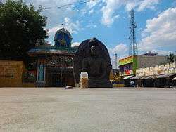
Temples
_Temple_entrance.jpg)
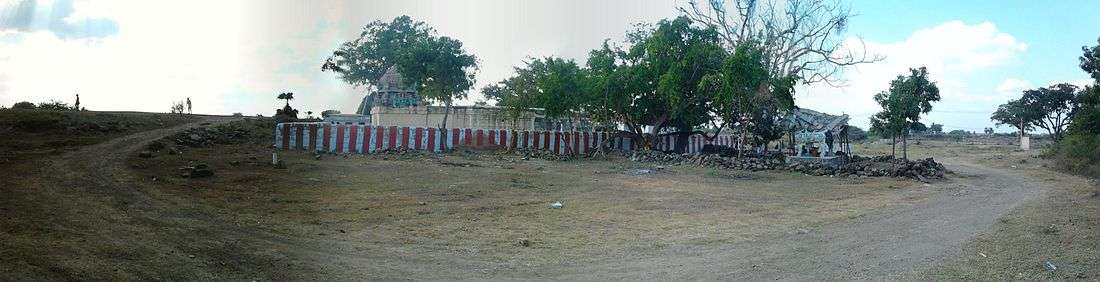
- Lord Shiva temple
- Krishna Temple
- Selliyamman Kovil
- Maariyamman temple
- Perumal temple
- Ayyanar temple
- Velaiyar Swamigal Jeeva Samadhi
Churches
Perumathur belongs to the Eraiyur parish. Perumathur, Poonagaram, Milakainatham, Nellore and Keelapuliur are its substations.
There is a chapel in the Perumathur and Poonagaram villages.
Education
Colleges near Perumathur:
- Srinivasan Engineering College
- Thanthai Roever College of Nursing
- Modern Arts and Science College
- Bharathidhasan university college of women in veppur
- Dhanalakshmi Srinivasan medical college and hospital
- Roever engineering college
Schools near Perumathur[2]:
- GHSS
- St. Johns High School, Permathur[3]
- Nehru Higher Secondary School, Eraiyur (school in Perambalur district)
- St. Mary's R.C. School, Eraiyur
Economy
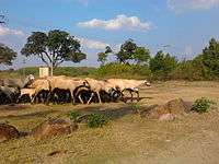
Agriculture is the backbone of Perumathur's economy, thus causing cultivation to be highly prevalent in this area.
References
- ↑ "Census of India 2011: Data from the 2011 census, including cities, villages and towns (Provisional)". Census Commission of India. Archived from the original on 2004-06-16. Retrieved 2008-11-01.
- ↑ "Archived copy". Archived from the original on 2012-07-28. Retrieved 2012-04-26.
- ↑ "Archived copy". Archived from the original on 2012-07-28. Retrieved 2012-04-26.
External links
| Wikimedia Commons has media related to Perumathur. |